Showing posts with label low level aerial photography. Show all posts

Friday

Aerotrekking

With the recent media interest in John McAfee the Sky Gypsies Blog has received a significant increase in traffic.  For the most part, based on keyword activity, this is an interest in the concept of Aerotrekking.  It seems worthwhile to answer this interest with a review of the idea of Aerotrekking and its utility.

The concept of low level aviation is not a new idea, it is practiced by the military and aerial firefighters on a regular basis.  It is an activity weight shift control aircraft pilots have engaged in for many years and since the inclusion of these aircraft into the Light Sport Aircraft category the FAA has acknowledged low level flying by exempting these aircraft from minimum altitude requirements.  It recognizes the fact that weight shift control aircraft (commonly know as trikes) are frequently flown at less than the minimum altitude of 500 ft, found in the regulations.  In fact the altitude for many of the pilot maneuvers required by the FAA during pilot certification are carried out at 400’ AGL (practical test standards).

The question then arises is this inherently dangerous?  Weight shift control light sport aircraft evolved from hang gliders and without an engine they revert to this mode, large gliders.  So the answer would have to be no, the danger does not increase with low level flying.  But as with any aviation activity keeping a landing zone within gliding distance is always advisable.  In fact, early commercial aviation in the United States was serviced by a series of Intermediate Fields which addressed this specific issue.  In addition, low level aviation is clearly not something practiced in congested areas, controlled airspace, or in areas unfamiliar to the pilot.  FAA regulations prohibit that sort of activity and unfamiliarity with the terrain can lead to negative interactions with ground based obstructions (power lines, towers, windmills, etc).  While the commonly held misconception is that if you let go of the controls the aircraft will crash is false, it is especially true with weight shift control aircraft.  Wings are designed and tuned to return to straight and level flight when the controls are released and here is a video demonstrating the stability of these aircraft flying hands off.  They also fly fine without an engine (see this video).  Weight shift control aircraft also have a built in secondary energy management system.  Since the carriage, pilot, and engine are a pendulum below the wing additional energy for landing may be acquired by pulling in on the control bar, storing energy for landing by increasing speed without increasing the throttle.  This stored potential energy is translated back into kinetic energy when landing by letting the control bar out when entering ground effect and slowly losing airspeed.

The next question to arise is why fly low?  The answer to this question is subjective.  For some it may the adrenalin rush gained from skimming along at 5 or 10 ft above the ground.  While for others it is the perspective gained from being just above the landscape.  We commonly view the world from eye level, about 5-6 ft off the ground,  but the perspective changes dramatically when one rises to 15 or 20 feet.  One’s perspective of the landscape completely changes the world takes on a completely different view when flying above it.  For example this low level aerial view of eroded rock formations in the Animas Valley of New Mexico.
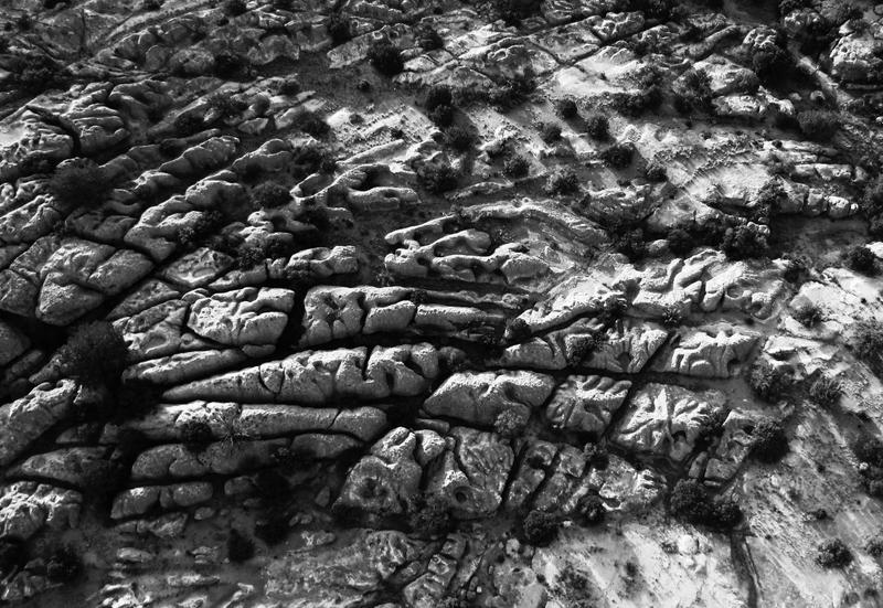
Gaia's Brain

Or this multi overlapping image panorama taken while flying up and out of an extinct maar volcanic crater in Arizona.  Or this view of erosion features in the San Simon riverbed.

Mesa in Miniature -tiltshift


Weight shift control light sport aircraft also make exceptional video platforms and a number of pilots around the world routinely post videos of a variety of flying adventures.

For more information on weight shift control light sport aircraft please visit Trike Pilot Social and read about these interesting aircraft.  For more examples of low level aerial images please see the Boot Heel Photo-documentation Project.

Thursday

Goggle and 3D Imagery

Google's mapping applications, Google Earth and Google Maps, are extremely useful tools for low level aerial photographers and a number of previous posts have addressed the utility of these mapping tools including:
Integrating low level aerial photographs into Google Earth
The Sky Gypsies:  Even Google Earth is getting into low level aerial photography
Integrating Google maps with with Flight paths, photographs, and video

But Google has just released a new video, shown below, and described plans to incorporate 3D imagery of several cities created using a fleet of small aircraft (light sport aircraft?).  What is interesting are the camera angles and scenes presented.  Viewing any random video produced by a trike pilot at Trike Pilot Social and the same viewpoints, camera angles, and scenes may be observed.  It suggests that Google has figured out that just rising above the landscape even a 100' gives a whole new perspective to the landscape. It is as interesting to observe the use of relative motion in presenting heir images.  Relative motion, the movement of foreground objects with respect to background objects, only enhances the results.


Tuesday

Photograph of the Dirt

Below is a finished photograph of another erosion feature from the San Simon Valley.  Erosion of denuded landscape produces fractal like patterns which can only be appreciated from the air and is just one of the many uses of a weight shift control light sport aircraft.

The landscape takes on a completely different character from just a few feet above the ground and flying at low levels across open countryside is one way to appreciate the beauty.  Here is a link to a truly spectacular video of low level aviation from Washington State.  Entitled One October Evening this video demonstrates the beauty of low level aviation in a weight shift control light sport aircraft.

Erosion features in the San Simon Valley near Rodeo New Mexico

Monday

Integrating low level aerial photographs into Google Earth

Google Earth is great. It is used to plan many of the low level aerial photographs that are seen through out this site. The tilt down feature allows a preliminary look at the landscape and potential photographs may be planned from the comfort of the desk as opposed to flying around hoping to stumble across a photographic opportunity. But once made and posted there is little location information available to the viewer. Even when the photograph is submitted and accepted by Google Earth its location is never the exact position where the photograph was taken. In an attempt to provide more context specific information about some of the low level aerial photographs, 3 have been incorporated into Google Earth using the add a photo feature. The photograph can be precisely placed on Google Earth and then using the opacity feature collect a series of screen shots that can be animated. Below is a first pass at incorporating images into Google Earth and animating the transition from Google to photograph.

Saturday

Abandoned Ranch

The maintenance on the Air Creation 582 Buggy is finished and test flights followed late yesterday, but took some time to catch a few photographs.  Below are 2 photographs from the flight.  One is an abandoned ranch that sits just to the north east of the runway. While the roof is long gone the simple cattle maze is intact.  The second is of a small erosional feature just south and appears to be the only drainage used to fill the cattle tank during the monsoon season.

Abandoned Ranch in the San Simon Valley

Solitary erosion feature

Thursday

Low Level Aerial photography in Animas Valley

Below is an example of a low level aerial photograph taken from a weight shift control light sport aircraft.  The maneuverability, open cockpit, and high wing make these aircraft ideal aerial platforms for photography.  It is relatively easy to get in low and close to a subject without compromising safety and the freedom of an open cockpit allows multiple angles for photography.

The post production modifications included a slight decrease in saturation since the landscape is a fairly uniform brown and an added tilt shift effect to enhance the 3D nature of the hilltop that is the subject of the photograph.  As in this photograph, color can also be used to increase the 3D effect.

Looking north towards Antelope Pass in the Animas Valley, New Mexico

Monday

Low Level Aerial Photographs in Flickriver

The low level aerial photographs are spreading around.  Several non aviation sites have been using some of the photographs, for example a Pakistani music site and a weight loss control site have been reposting some of the photographs, but here are links to several Flickrivers where the low level aerial photographs have appeared.  One of the goals of aerial photography based on the Aerotrekking concept was to demonstrate just what could be done with this sort of aircraft in the hands of a trained pilot and record the unique perspective from these aircraft.  The majority of photographs are under a Creative Commons license allowing non commercial use of the images.  If viewers like the photographs then they should be able to use them, just give credit and a link if  back to either the source or The Sky Gypsies would be appreciated.

Even Google is Getting into Low Level Aerial Photography

Google hosts the Sky Gypsies blog and Goggle Earth is the repository for many of the low level aerial images of New Mexico's bootheel created from weight shift control light sport aircraft. In fact Google Earth is routinely used to design low level aerial photographs using the tilt down feature. I have written several postings about the utility of Google Earth and how to create low level aerial photographs to enhance the viewers experience. It appears that now the Google folks are getting into the idea themselves. In this article and this article, Google is reportedly testing a small aerial drone with photographic capabilities. The article suggests that the inclusion of low level aerial images would complement the satellite images and street views available on Google Earth and Google maps. I fully agree and I went so far as to submit a proposal to them, see text below. It was also partial impetus for the creation of the bootheel photodocumentation project, which brings together a number of the aerial images from the multi-image aerial panoramas (big picture) to the low level pictures of erosion features (the little picture) in a demonstration of what can be achieved with weight shift control light sport aircraft.

While the battery powered quadcopter can stay up for an hour gathering data I would like to point out that only a pilot with a photographers eye can find the great shot and then place the aircraft in a position to get the picture. That takes planning but also a good deal of moving the aircraft around while looking at the scene from a number of different angles to get the right view. While 2 people (a pilot and a photographer) may be able to coordinate their activities a single person can do the job faster, easier, and get the aircraft into areas ground based personnel can not reach. Finally, a word of advice, the coolest aerial photographs are those taken either looking out or looking up at ground based features.

Draft of proposal submitted
Creating meaningful images takes time, patience, and skill, and the submitted results visible on Google Earth attest to the creativity of various photographers. But as human beings we are limited to the creating photographs within about 6 feet of the ground and generally within walking distance of our car. We circumvent this limitation by climbing buildings or any structure to get a better view, or by driving till the road ends then hiking up mountains, standing on cliff edges, or hanging off ropes, all in an effort to capture a unique image. But there are severe limitations in accessing many areas of the country. Land ownership prevents many from going where photographic opportunities exist. Landowners, especially in the west, jealously guard access to their property even if the photographer is only crossing to access public lands. But while the land maybe owned by an individual, the airspace is not. Rather it is regulated by the Federal Government and belongs to no individual and best of all starts just above the dirt.

Using open cockpit weight shift control light sport aircraft, affectionately known as trikes, a photographer can place the camera anywhere from 6 feet on up. In addition by flying low (within the regulations) they can place the camera view on any spot not accessible to the ground based photographer creating either landscape photographs or up close shots of specific subjects without trespassing and becoming the immediate recipient of a landowners wrath.

So how does Google Earth fit in with this “extremely low flying aircraft as a tripod” approach to photography? Well, it can be stated in a single word, composition. Flying around looking for the right scene rapidly becomes time and cost prohibitive, but with Google Earth and high resolution satellite imagery it is possible to design a landscape photograph before every going outside. Time spent working with Google Earth and the tilt down feature allows the photographer to test different camera placements from the flats of the valley to inaccessible hilltops and get an idea if there is a hidden photograph waiting to be captured from that vantage point. If so, it then becomes a matter of flying to the spot and placing the aircraft at the altitude of the hilltop or close to the ground and then capturing the image. That is not to say it is an easy task using a light sport aircraft as a tripod. There are still all the usual photographic considerations such as lighting which must be accounted for. In addition, piloting an aircraft and taking photographs takes some expertise especially in tight quarters. Weather also plays a major factor, winds can move the aerial tripod in different directions ruining a shot. But the amount of time and energy saved in preplanning photographs using Google Earth is well worth the effort.

This is not aerial photography in its strict sense. The idea here is to place the aircraft in a spot normally inaccessible to ground based photographers and capture an intriguing image with the goal of creating images that could have been taken from a particular spot in a conventional manner but weren’t. For example, this photograph was taken from a height of about 75 feet, well below the surrounding hilltops, and captures Granite Peak from an unusual angle. It is 1 of 3 photographs made of Granite Gap and accepted at Google Earth. Or this photograph of Animas New Mexico was taken from the top of a local hill.

So by first using Google Earth to compose photographs then placing an aerial tripod in remote or inaccessible places it is possible to create scenic landscape photographs that have a much higher probability of success.

Wednesday

Photosynth Point Cloud of Paramore Crater

Microsoft's Photosynth has an interesting feature that is particularly applicable to aerial photosynths. Below is the point cloud from Flying below ground level that I created by circling up and out of the crater while photographing the interior. The data points create a nice 3D rendering of the crater which can be viewed by clicking on the second button from the right and choosing "overhead". This will bring up a complete view of the crater based on the point cloud.


Room with a View

Sitting on the edge of the dry San Simon River bed this stone room ruin is slowly eroding out of the ground. Hemispherical in shape and built of flat stone a large lintel stone is visible on one end. It appears that someone has carefully cleared out the room but no other activity in the vicinity is apparent. Evidence of past inhabitants can be found all along the San Simon River. A large ruin lies about 8 miles to the southeast along the opposite side of the river, about a days walk, and this site is within a mile of a previously described Mimbres site on federal land. Whether more extensive material is present will require some ground investigation.


Click on images to open a larger version in a new tab.

Thursday

Little Worlds

It has been argued that the San Simon Valley and the whole bootheel exists in a bubble moving at close to the speed of light. This idea can be extended photographically by taking low level aerial panoramic photographs and circularizing the image. A number of software packages are available to process images this way and some are free. Here is a YouTube video on the process.


Chiricahua Mountains
Peloncillo Mountains
Peloncillo Mountains near Antelope Pass

Tuesday

Edge of the Playa

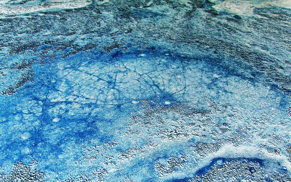
Drainages and erosion in the desert often produce unique patterns best appreciated from the air. The larger patterns are frequently found along arroyos where their intricate design is a function of water flow and soil composition, but interesting patterns also emerge around the edges of playas. The playas are the lowest areas in these enclosed drainage basins and where the dip is the shallowest. One would not expect unusual patterns where the water flow rate is the lowest but contrary to this expectation a myriad of branched patterns exist along the edge of this water filled playa. Resembling capillary beds these small drainage features can be found all around the edge of the playa and are best visualized in a water filled playa.


Click each photograph to enlarge and open in a new window.

Sunday

The Monsoons are Over

The monsoons season was late this year. It traditionally begins on July 4th but this year was late. There were periods of rain and the playas of the bootheel filled. Below is a low level aerial photograph of the playa in Playas Valley filled with monsoon runoff.


Click to enlarge

Saturday

Bootheel Photodocumentation Project in Google Earth: Recent Submissions

As mentioned in earlier posts, a number of the low level aerial photographs taken from weight shift control aircraft have been submitted to Google Earth for inclusion on the map. Below is an interactive Google Earth map with many of the photographs from the project.


Tuesday

The Bootheel Photo Documentation Project, First Volume

The first volume of low level aerial images from the bootheel has been submitted and a proof copy should arrive early next month. Below is the cover of the first volume, a 40 page compilation of aerial panoramas, intermediate view shots, and close up views of the landscape and drainage features found in the high desert of bootheel of southern New Mexico. Plans are underway for additional volumes each with the same format.


Friday

Bootheel Photodocumentation Project: Update

One hundred and ten of the photographs submitted to Google Earth have now been accepted for placement on the map, a better than 95% acceptance rate. Covering the San Simon and San Bernardino Valleys, Animas Valley, and parts of Hachita Valley these low level aerial photographs capture some of the uniqueness of this sparsely populated area of the country. A great deal of air time has been spent and thousands of photographs taken to convey some of the emotions evoked by this part of the country. Flying around the bootheel is a unique experience.

In the process of documenting the bootheel a number of techniques have been used, not all of which lend themselves to viewing in Google Earth. Large panorama photographs, tiltshift modified photos, and photosynths have all been created. Each technique is a slightly different way of "seeing", and each brings something unique to the subject photographed.


Maps with photographs from the Bootheel Photodocumentation Project currently include:
Google Earth
Flickr
bing maps


I still hold a fascination for erosion features (rills) found across the bootheel. The summer monsoons can generate a lot of water in a short period of time and the patterns the water creates on the desert surface can only be appreciated from the air.

Saturday

Google versus Life


Click on the photograph to enlarge and open in a new window.

Presented on the left is an aerial image made in the pass between the Little and Big Hatchet Mountains on the east side of the bootheel in New Mexico about 12 miles west of the Mexican border as part of the bootheel photodocumentation project. On the right is the corresponding view from Google Earth. Note the similarities in the outlines around the different peaks but increased detail visible in the aerial photograph. While satellite imagery and the algorithms that allow the viewer to pan down from an overhead satellite image are very good, putting an aircraft in the same position in space and capturing an image increases the detail and information available to the viewer.

Wednesday

High Altitude or Low Altitude Aerial Images? Or the Big Picture versus the Little Picture

At the bottom of this page is a slideshow "Desert Drainages" containing images of various erosion and drainage features, rills, found around the bootheel of New Mexico that have been photographed from an open cockpit weight shift control light sport aircraft at very low altitudes, anywhere from about 20 feet (low pass) to 200 feet. These features have have a number of things in common but he most important commonality is the lack of discernible scale to help the viewer interpret the size of individual features in the photograph. These images are primarily oblique view low level aerial photographs, as opposed to ground based horizontal views, and the lack of scale and camera angle leads to confusion as the brain tries to fit the image into a known category.

Since the start of the space age in 1957 the public has been fascinated by views of the earth from above and NASA has complied with the publication of satellite imagery, first as black and white images and now as false color images. The USGS maintains a website that is devoted to displaying Landsat-7 images of the earth. The Earth as Art has a number of satellite images which are in and of themselves are art.

Compare the following image pairs, in the 4 sets the first image is a landsat-7 or space station image taken from orbit and the second image is a low level aerial photograph taken from less than 200 feet AGL. Note the lack of scale in the low level aerial image creates the impression the low level images were taken from high altitude. Without suitable references the brain interprets the images placing them in a familiar category, namely high altitude images. Fifty feet or 150 miles it's all the same, it's turtles all the way down.


DesolationCanyon


Low level aerial photograph View On Black


Guinea-Bissau


Low level aerial image


West Fjords, Iceland


Low level aerial image


Seoul, South Korea


Cities from Space, a low level aerial image

Friday

Everybody Aerotrekks

Everybody goes Aerotrekking at some time or another, even the government is using the technique to monitor rangelands. The USDA Rangeland Research Unit is using light sport aircraft and low level aerial photography to monitor the health of rangelands and compliance with revegetation projects in western states. A 5 year project, Vegetative Monitoring of Rangelands Using Low-Level Aerial Photography is using a light sport aircraft to monitor and quantify changes in grassland in response to grazing and activities associated with oil and natural gas recovery.

In a comparison of techniques it was found that there was no statistical difference between laser-point frame imagery, 2m AGL imagery, and low level aerial photography (100m AGL imagery) methodologies in the pooled dataset. In fact the Standard Deviation, corrected sums of squares, COV, and SE were all less than half of the laser-point method and less than the other methods as well. The authors conclude that “The reduction in cost per sample, the increased speed of sampling, and the smaller standard deviation associated with the 100-m AGL digital imagery are compelling arguments for adopting this vegetation sampling method.”

Here is an article on the application of the technique for Riparian monitoring using 2-cm GSD aerial photography in the journal Ecological Indicators

Project Summaries using low level aerial photography
Low Altitude, High-Resolution Digital Aerial Photography, and Computer Enhanced Data Analysis for Monitoring Rangeland Resources is a project to examine different land management regimes and quantify their effect on the ecological resources.

Ground and Aerial Analyses of the Vegetation in Selected Allotments of the Grand River and Missouri National Grasslands

RANGELAND ECOSYSTEMS: CHARACTERIZATION, MANAGEMENT, AND MONITORING

People can come up with the strangest excuses to go Aerotrekking, but I’m glad to see the scientific community realizing the utility of light sport aircraft for low level aerial photography, data acquisition, and monitoring.

Monday

Gaia's Brain: Low Level Aerial Photosynth

Just finished a 76 image photosynth of Gaia's Brain (see preceding post). It took 2 flights to get the photographs and Microsoft's Photosynth to make sense of them. On the second flight 2 Border Patrol trucks were waiting for me. I dropped low and grabbed this photograph, waved, and start gathering photographs for this photosynth. There's me flying in circles photographing rocks and the Border Patrol watching. Kinda like watching grass grow, it could not have been very exciting. But I do like having the backup.


Here is the final product, there are at least 2 halos I've found indicating that I managed fairly good coverage of Gaia's Brain. You may also view Gaia's Brain on BAlvarius' page at the photosynth site where a larger version is available. While the original "Gaia's Brain" black and white tilt shift photographs may not appear to be aerial photographs the photosynth should put to rest any doubt (and I have witnesses).


A simple multi-image panorama may be seen here.