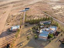
Everybody goes Aerotrekking at some time or another, even the government is using the technique to monitor rangelands. The USDA Rangeland Research Unit is using light sport aircraft and low level aerial photography to monitor the health of rangelands and compliance with revegetation projects in western states. A 5 year project, Vegetative Monitoring of Rangelands Using Low-Level Aerial Photography is using a light sport aircraft to monitor and quantify changes in grassland in response to grazing and activities associated with oil and natural gas recovery.
In a comparison of techniques it was found that there was no statistical difference between laser-point frame imagery, 2m AGL imagery, and low level aerial photography (100m AGL imagery) methodologies in the pooled dataset. In fact the Standard Deviation, corrected sums of squares, COV, and SE were all less than half of the laser-point method and less than the other methods as well. The authors conclude that “The reduction in cost per sample, the increased speed of sampling, and the smaller standard deviation associated with the 100-m AGL digital imagery are compelling arguments for adopting this vegetation sampling method.”
Here is an article on the application of the technique for Riparian monitoring using 2-cm GSD aerial photography in the journal Ecological Indicators
Project Summaries using low level aerial photography
Low Altitude, High-Resolution Digital Aerial Photography, and Computer Enhanced Data Analysis for Monitoring Rangeland Resources is a project to examine different land management regimes and quantify their effect on the ecological resources.
Ground and Aerial Analyses of the Vegetation in Selected Allotments of the Grand River and Missouri National Grasslands
RANGELAND ECOSYSTEMS: CHARACTERIZATION, MANAGEMENT, AND MONITORING
People can come up with the strangest excuses to go Aerotrekking, but I’m glad to see the scientific community realizing the utility of light sport aircraft for low level aerial photography, data acquisition, and monitoring.
Friday
Everybody Aerotrekks
Posted by
Unknown
Labels:
Aerotrekker,
Aerotrekking,
low level aerial photography,
rangeland monitoring,
US government,
USDA
Subscribe to:
Post Comments (Atom)


guest blogger invitation
ReplyDeleteHello,
This is Rose writing from www.huliq.com. I visited your blog and liked your content.
Would you be interested to send us a guest post on any of the issues related to the topics that you cover in your blog. We will publish it in our site www.huliq.com
In return with each guest blog we will give one link in the author's byline back to your blog. We only ask that the guest post ( we prefer it be a news coverage, sources can be Google News, CNN, MSNBC, Yahoo News, BBC and others) be a unique story and not be published in your blog.
HULIQ is indexed by Google News and Google requires that the length of the unique news is at least 5 paragraphs. We desire it to be at least 6 paragraphs if possible. And that all need to be a unique content. Once you send us a new story totally unique we will immediately publish it with you link in it, and within 15 minutes it should be indexed by Google News.
Also, please structure author byline as follows:
author's name:
author's e-mail:
author's blog url:
Please let me know if you may have any questions about www.huliq.com.
If you want to consult the topic with me first that's perfectly fine as well.
Many thanks
ruzik.mail@gmail.com