Showing posts with label San Simon Valley. Show all posts
Showing posts with label San Simon Valley. Show all posts
Monday
Monsoon Season in New Mexico
Monsoon season in the southwest means afternoon thunderstorms and thunderstorms can result in rapidly changing meteorological conditions. The outflow from even small thunderstorms can produce a gust front which can interfere with a pilots control. He is the link to a short time lapse video of a single thunderstorm which produced a gust front in the San Simon Valley the other day.
Tuesday
The Newest Aiport in the the San Simon Valley
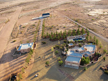
Lizzy Lizard, 8AZ5, is listed in AirNav. The single strip 19/01 is located 3 miles south of the Rodeo airport and 1.7 miles west of Amigos del Cielo. As a private air strip, prior permission is required before landing. The 2500' x 60' runway is not paved.
Saturday
Abandoned Ranch
The maintenance on the Air Creation 582 Buggy is finished and test flights followed late yesterday, but took some time to catch a few photographs. Below are 2 photographs from the flight. One is an abandoned ranch that sits just to the north east of the runway. While the roof is long gone the simple cattle maze is intact. The second is of a small erosional feature just south and appears to be the only drainage used to fill the cattle tank during the monsoon season.
 |
| Abandoned Ranch in the San Simon Valley |
 | |
| Solitary erosion feature |
Monday
More Aerotrekkers in the Valley
The wide open expanses in the bootheel of New Mexico just invite low level flying. Here is another military transport headed south past Amigos del Cielo Airpark. At just a couple of hundred feet the views of the mountains and valley are great.
 |
| The military out aerotrekking in the San Simon Valley |
Early Aviation in the San Simon Valley
Early aviation routes frequently followed the iron compass (railroads) insuring visible landmarks all along the route. The location of the Rodeo Intermediate field with it's big red directional arrow is a good example. The San Diego (and Los Angeles) to El Paso air route followed the old El Paso and Southwestern rail line from Douglas AZ through the San Simon Valley and on to El Paso and many other intermediate fields can be found associated with railroads. So while the San Simon Valley has an established history of aviation, this history can be traced back even further than the early commercial air routes and air fields. The first transcontinental flight in US history also passed across the San Simon Valley in it's journey from Lordsburg to Wilcox on the way to the west coast.
The aircraft was a Wright Brothers modified model B biplane (known as the EX model) named after the soda Vin Fiz, Armour's newest grape soda, and was piloted by C. P. Rodgers. After 90 minutes of flight training then solo Rodgers purchased a Wright Flyer, then persuaded the Armour company to provide sponsorship. The company provided a complete support crew and and a 3 car train for the trip which would accompany Rodgers along the iron compass across the US.
The trips route (see map below) started on September 17, 1911, in New York city, then to Chicago. The route turned southwest across the heartland of the US and into Texas. A westerly course was re-established after reaching San Antonio. The route went through El Paso and into New Mexico. At one point less than 20 miles into New Mexico Rodgers spent several days stuck in the sand at the El Paso and Southwestern siding town of Mastodon (1). He used a hand car as a catapult for takeoff, crashing the hand car into an oncoming train. His route then went northwest to Lordsburg, through the San Simon Valley east to west, and then on to Wilcox. Rodgers reached the Pasadena California 49 days later. But suffered another mishap while making the hops to the coast. After 3 weeks recovery, on December 10th he landed on the beach of the Pacific Ocean completing the first trans continental flight.
References:
Back to Basics in the Vin Fiz Flyer
The Epic Flight of the Vin Fiz Flyer
The Vin Fiz - The First U.S. Transcontinental Flight
Vin Fiz Flyer

Tuesday
Video of Lightening Storm
Here is a short video from last nights monsoon storm. It was a spectacular lightening display but difficult to catch on video. The sensitivity of the camera chip is lower than the human eye. As a result what I saw as constant flashes of lightening did not always register on the camera. But here are a few of the brighter flashes.
Monday
Self Portrait or How it is done
They are worse than automobile drivers on cell phones, pilots with cameras that is.
Caught this image of my reflection in the GPS while photographing a Trinchera in the southern San Simon Valley at the mouth of Skull Canyon and it captures the ingredients required to make low level aerial photographs. The minimum prerequisites are calm air and good light. Calm conditions make all the difference when flying in confined areas or at low altitudes and good light makes all the difference in creating an interesting photograph. Then the photographic target is flown at series of decreasing altitudes looking for potential problems and obstacles (canyon walls, the ground, small hills, and power lines), all the while rechecking the winds and figuring out the best line past the target. Especially important is a flight path where I will have enough room to turn around once finished running the camera. Once this is worked out, I pick a line along the photographic target and do a low pass towards the target and begin shooting. This is repeated several times until I have something acceptable or I abort and come back another day and try again. I have photographed some sites numerous times because something was not correct, generally the winds. The goal is to bring back interesting views of the landscape and other features and not to fly into the ground.
On this particular flight I had to deal with a canyon entrance and high rock walls with a rocky hill in my flight path past the target. So just after taking the photographs I had to climb and turn to fly over the hilltop shown below.
 Self portait

Skull Canyon entrance and rocky hill on the left, shown below in detail.
 Early high test pass over rocky hill obstacle.
Sunday
Cerro de Trincheras in the San Simon Valley
The San Simon Valley has been a cross roads for a number of cultures and evidence of their occupation can be found along the length of the valley. One of the more enigmatic and less understood sites found in New Mexico, Arizona, and northern Mexico are walled hilltops. These Cerro de Trincheras or fortified hills were first recognized in the late 1800's. The best known and investigated of the Trincheras is Cerro de Trincheras, located in northern Sonora Mexico. The site can be seen from over 25 miles away, is composed of over 900 north facing terraces, and was occupied between 1300-1500 CE. Of those sites analyzed, occupation of the Trincheras occurred in 3 phases. The oldest site was occupied about 1000-800 BCE, then several from a period of around 200-500 CE, and a final phase of construction and occupation around 1300-1500 CE. The Trincheras phenomena are not isolated temporally or spatially occurring over a period of 2500 years and over an area of 50,000 square miles. As such they may represent the work of the local agrarian peoples. The function of these sites is somewhat controversial but the it has been suggested that they served as:
1. Refugia created by the locals to protect their harvests from other groups.
2. Village sites.
3. Communication centers, based on hilltop locations.
4. Specialized centers for public events and ceremonies.
5. Terraced gardens.
While Arizona and Mexico have the highest density of Trincheras, several are known from New Mexico. This site was discovered on a flight from the Sky Gypsies complex at Amigos del Cielo airpark, aerial photograph 1. The hill rises 20 meters from the surrounding valley floor and the walled hilltop has a well defined outer wall and fainter inner wall, aerial photographs 2 and 3 . The outer oval wall encloses an area 68 x 52 meters, while the inner circle is about 30 meters in diameter. Inside the inner wall there are at least a dozen round rooms discernible, some created using existing rock outcrops, aerial photograph 4.
Who was responsible for the construction of this particular Trincheras and its function await further archeological studies.
Aerial photograph 1

Aerial photograph 2

Aerial photograph 3

Aerial photograph 4

Click to enlarge
Aerial photographs of other Trincheras may be found here and here. A description of Cerro Juanaquena a Trincheras site in northern Mexico may be found here.
Monday
Pronghorn Antelope (Antilocapra Americana) - Species of the Day

Below is a single male (top) with the characteristic black cheek pouches and 2 females. Photographed east of the mouth of Horseshoe canyon, Chiricahua Mountains, on the east side of Highway 80.

The pronghorn antelope (Antilocapra Americana) is found throughout the
western United States. In the San Simon and San Bernadino Valleys straddling the Arizona New Mexico border Pronghorn can be found in the open grasslands. The only species in the family Antilocapridae, pronghorns have characteristic branched keratinized horns which are shed yearly leaving only the bony core. An individuals range will cover 20-40 square miles but they will congregate into herds. Males will collect harems of 3-8 females prior to mating. Generally one or two fawns are produced in the in late spring or early summer. Pronghorn can be found in the vicinity of Rodeo at the base of the Peloncillo Mountains.
Subscribe to:
Posts (Atom)


 Posts