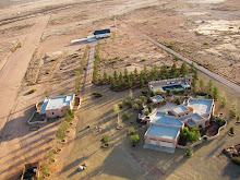
Google's mapping applications, Google Earth and Google Maps, are extremely useful tools for low level aerial photographers and a number of previous posts have addressed the utility of these mapping tools including:
Integrating low level aerial photographs into Google Earth
The Sky Gypsies: Even Google Earth is getting into low level aerial photography
Integrating Google maps with with Flight paths, photographs, and video
But Google has just released a new video, shown below, and described plans to incorporate 3D imagery of several cities created using a fleet of small aircraft (light sport aircraft?). What is interesting are the camera angles and scenes presented. Viewing any random video produced by a trike pilot at Trike Pilot Social and the same viewpoints, camera angles, and scenes may be observed. It suggests that Google has figured out that just rising above the landscape even a 100' gives a whole new perspective to the landscape. It is as interesting to observe the use of relative motion in presenting heir images. Relative motion, the movement of foreground objects with respect to background objects, only enhances the results.
Thursday
Goggle and 3D Imagery
Posted by
Unknown
Labels:
aircraft,
Google 3d imagery,
Google maps,
light sport aircraft,
low level aerial photography
Subscribe to:
Post Comments (Atom)


No comments:
Post a Comment