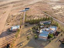
Google Earth is great. It is used to plan many of the low level aerial photographs that are seen through out this site. The tilt down feature allows a preliminary look at the landscape and potential photographs may be planned from the comfort of the desk as opposed to flying around hoping to stumble across a photographic opportunity. But once made and posted there is little location information available to the viewer. Even when the photograph is submitted and accepted by Google Earth its location is never the exact position where the photograph was taken. In an attempt to provide more context specific information about some of the low level aerial photographs, 3 have been incorporated into Google Earth using the add a photo feature. The photograph can be precisely placed on Google Earth and then using the opacity feature collect a series of screen shots that can be animated. Below is a first pass at incorporating images into Google Earth and animating the transition from Google to photograph.
Monday
Subscribe to:
Post Comments (Atom)


No comments:
Post a Comment