 |
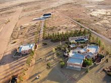
| Newest TRF includes the Painted Pony Resort |
Showing posts with label TFR. Show all posts
Showing posts with label TFR. Show all posts
Wednesday
Another Updated TFR
The temporary flight restrictions in place over the Chiricahua Mountains have been expanded again. Below is a Google Earth Screen capture showing the outline of the new TFR which extends from the surface to 12,000' MSL. The latest information on flight restrictions may be found here. An aircraft violated the TFR the other week and landed at Amigos del Cielo air park which is being used as a helibase by the firefighters.
Visual Representation of Horseshoe 2 Fire TFR
There is a 13 nm radius TFR in place over the Chiricahua Mountains in response to the Horseshoe 2 Fire. Below are 2 screenshots of the Google Earth map with the TFR overlaid and showing the extent of the fire as of 5/25/2011. Note that most of the valley around Rodeo New Mexico including the helibase at Amigos del Cielo fall under the TFR.


UPDATE:
6/08/2011
The 13 nm TFR center has been moved to 31º52'00" N, 109º17'00" W (click on coordinates to see the updated TFR).


UPDATE:
6/08/2011
The 13 nm TFR center has been moved to 31º52'00" N, 109º17'00" W (click on coordinates to see the updated TFR).
Monday
5/9/2011 Temporary Flight Resrictions, TFR
Two temporary flight restrictions are in place in the bootheel of New Mexico and nearby in Arizona. The one in New Mexico is along the border with Mexico in the Animas Valley and is in response to the Cloverdale fire. The other is near Portal Arizona and is in response to the Horseshoe fire which started yesterday. Both of these TFRs prohibit the operation of aircraft within their respective boundaries to minimize interference with fire fighting activities.
New reports on the Horseshoe fire are just starting to come out.
UPDATE 5/11/2011
The runway at Amigos del Cielo Air Park is being utilized by helicopters from the fire suppression team. Be aware that helicopters are not flying regular patterns around the runway. If landing, be alert for unexpected air traffic.
UPDATE 5/15/2011
The Cloverdale Fire TFR has been removed from the FAA's TFR website, although the TFR over the Chiricahua Mountains remains in effect.
UPDATE 5/16/2011
The TFR for the Horseshoe Two fire has been increased in size from 5 miles to 8 miles in diameter. This now covers part of the valley that lies in AZ, New Mexico is unaffected. The sectional with the TFR may be viewed here .
UPDATE 5/23/2011
The TFR for the Horseshoe 2 fire has been increased to a radius of 13 miles and now covers the whole valley around Rodeo New Mexico
New reports on the Horseshoe fire are just starting to come out.
UPDATE 5/11/2011
The runway at Amigos del Cielo Air Park is being utilized by helicopters from the fire suppression team. Be aware that helicopters are not flying regular patterns around the runway. If landing, be alert for unexpected air traffic.
UPDATE 5/15/2011
The Cloverdale Fire TFR has been removed from the FAA's TFR website, although the TFR over the Chiricahua Mountains remains in effect.
UPDATE 5/16/2011
The TFR for the Horseshoe Two fire has been increased in size from 5 miles to 8 miles in diameter. This now covers part of the valley that lies in AZ, New Mexico is unaffected. The sectional with the TFR may be viewed here .
UPDATE 5/23/2011
The TFR for the Horseshoe 2 fire has been increased to a radius of 13 miles and now covers the whole valley around Rodeo New Mexico
Subscribe to:
Posts (Atom)


 Posts
Posts