Two temporary flight restrictions are in place in the bootheel of New Mexico and nearby in Arizona. The one in New Mexico is along the border with Mexico in the Animas Valley and is in response to the Cloverdale fire. The other is near Portal Arizona and is in response to the Horseshoe fire which started yesterday. Both of these TFRs prohibit the operation of aircraft within their respective boundaries to minimize interference with fire fighting activities.
New reports on the Horseshoe fire are just starting to come out.
UPDATE 5/11/2011
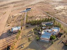
The runway at Amigos del Cielo Air Park is being utilized by helicopters from the fire suppression team. Be aware that helicopters are not flying regular patterns around the runway. If landing, be alert for unexpected air traffic.
UPDATE 5/15/2011
The Cloverdale Fire TFR has been removed from the FAA's TFR website, although the TFR over the Chiricahua Mountains remains in effect.
UPDATE 5/16/2011
The TFR for the Horseshoe Two fire has been increased in size from 5 miles to 8 miles in diameter. This now covers part of the valley that lies in AZ, New Mexico is unaffected. The sectional with the TFR may be viewed here .
UPDATE 5/23/2011
The TFR for the Horseshoe 2 fire has been increased to a radius of 13 miles and now covers the whole valley around Rodeo New Mexico
Showing posts with label Bootheel. Show all posts
Showing posts with label Bootheel. Show all posts
Thursday
Rodeo, New Mexico
Finished a couple of articles for Wikipedia on Rodeo and the bootheel. Have been working on rewrites for the article on the Chiricahua Mountains and added pictures to several other articles. All great places to fly down here which deserve more attention. The goal of this work is to get all the online information about Rodeo and it's environs "out there" and demonstrate activity, that is showcase what is going on down here.
Also finished creating a new blog for the Painted Pony Resort called "Blogging from the Boot Heel" to cover non aviation activities .
Also finished creating a new blog for the Painted Pony Resort called "Blogging from the Boot Heel" to cover non aviation activities .
Wednesday
The Biggest Movie Studio in the Bootheel of New Mexico
When making the aviation videos I would often joke that I ran the largest movie studio in the bootheel and it wasn’t my fault that there were no other studios down here. The landscape is expansive and the mountains create the perfect backdrop for aviation videos. The location is ideal, with 4 - 2500 square foot hangers at Amigos del Cielo airpark that doubled as sound stages and the Sky Gypsy complex as a location, it is easy to tell little stories. Now with the addition of the 80 acre Painted Pony Resort (PPR) the resources are even greater. PPR with its 3 houses, heated pool and spa, hanger and runways is located at the center of the San Simon Valley. The estate was designed with guests in mind and arriving on the property one is greeted with the view shown below. The Peloncillos as a backdrop to the main house and 2 guest houses.


The Ghost Town of Old Hachita
There are at least 2 ghost towns in the bootheel and the first one is now cataloged. Old Hachita on the east side of the bootheel sits at the base of the Little Hatchet Mountains next to Turquoise Mountain. It lies just on the east side of the contential divide and all photographic flights must cross the divide to reach the site. This link contains some background information on Old Hachita
 Click on photographs to enlarge
Others have photographed Old Hachita up close, photographs of the ghost town may be found here and here and there is a 28 image Photosynth of part of the town.
Of course the fellows from emergency services made an appearence during my flight (see below) and upon returning I found Border Patrol had also visited the airport. It's good to have somebody watching your back, even if they think you are a drug smuggler.

Tuesday
Desert Waterfalls
The tailings from abandoned mines spill down the steeply sided Granite Gap Mountain like waterfalls. The mine entrances resemble springs that are the source of the dirt and rock creating each waterfall. This aerial tilt shift photograph was taken at an altitude to show both the entrances and tailings waterfall.

Desert Waterfalls. Click photograph to enlarge.

Desert Waterfalls. Click photograph to enlarge.
Thursday
Selected Aerotrekking Images from the Sky Gypsies
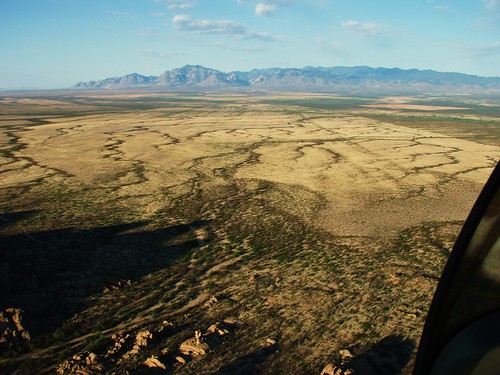
This was taken while exiting a small canyon on north of Highway 80 at Granite Gap about 10 miles south of I-10 in New Mexico. The spreading dark serpentine drainage's contrast with the light grasses, while across the valley in the background stands Portal Peak (8000') and the entrance to Cave Creek Canyon on the east side of the Chiricahua Mountains in southern Arizona.
Subscribe to:
Posts (Atom)


 Posts
Posts