Showing posts with label bootheel photodocumentation project. Show all posts

Sunday

Then and Now

Historical photographs are important tools in evaluating changes over time.  Especially important are landscape photographs which can document mans impact on the environment.  At the turn of the century landscape photography was particularly popular and many photographs survive today in archives, even those from remote areas such as the bootheel.

The Malpais Borderland is a roughly triangular area extending south of New Mexico Highway 9 to the border, with it's apex around Animas New Mexico and encompassing much of the bootheel.  While the Malpai Borderlands Group  is a " landowner-driven nonprofit organization attempting to implement ecosystem management on nearly one million acres of virtually unfragmented open-space landscape in southeastern Arizona and southwestern New Mexico."   As part of the documentation process R. M. Turner of the USGS rephotographed a number of sites where early photographs had been recorded to document changes in the vegetation and landscape as a result of man's influence.  Coincidentally, as part of the Bootheel Photodocumentation Project, one of these views was partially replicated.  The major difference between the earlier photographs and the most recent photograph were the 1913 and 1999 photographs were ground based while the most recent photograph was aerial and the subject chosen based on artistic merits not scientific documentation.

Below are three photographs of the Big Hatchet Mountains taken over a span of almost 100 years.  The first 2 photographs  are from the same spot atop one of the small hills between the Big and Little Hatchet Mountains.  While the third photo was taken from a weight shift control light sport aircraft just above the southern most small hill.  These photographs illustrate that:
1.  Low level aerial photography is a useful tool in photodocumenting the landscape on a similar scale as ground based photography with the advantage of easier access and unique perspectives if required.
2. The views around the bootheel are timeless.

September 29, 1913. Photograph by A. T. Schwennesen
May 12, 1999. Photograph by R. M. Turner

August 24, 2009. A low level aerial photograph from a similar location (slightly south).

The Monsoons are Over

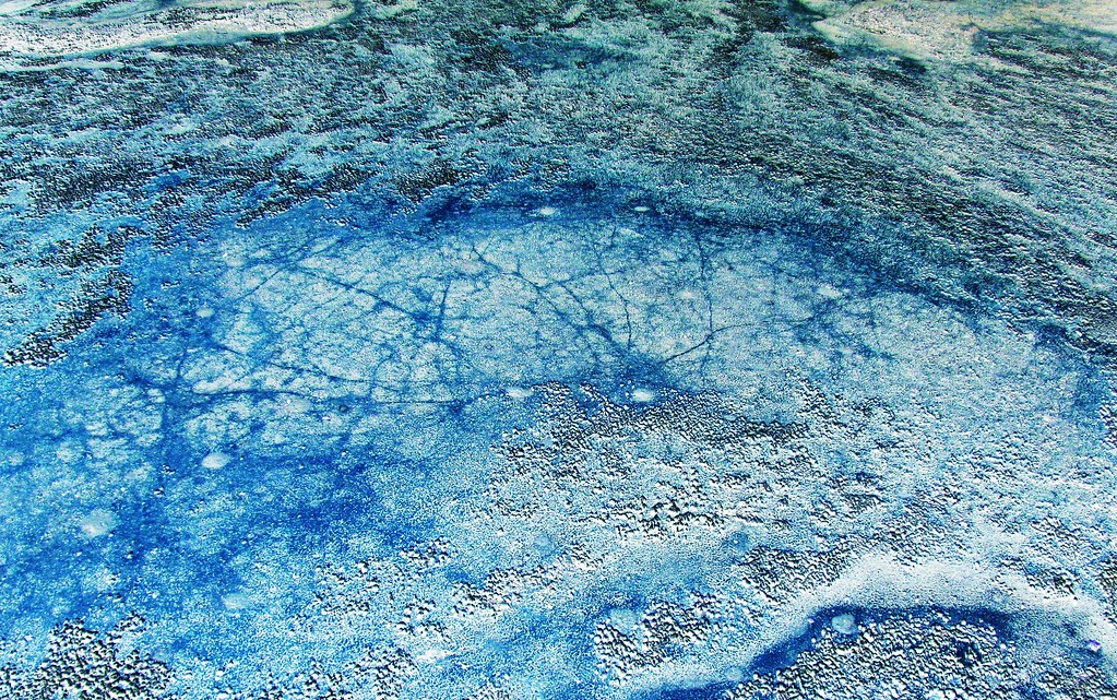
The monsoons season was late this year. It traditionally begins on July 4th but this year was late. There were periods of rain and the playas of the bootheel filled. Below is a low level aerial photograph of the playa in Playas Valley filled with monsoon runoff.


Click to enlarge

Saturday

Bootheel Photodocumentation Project in Google Earth: Recent Submissions

As mentioned in earlier posts, a number of the low level aerial photographs taken from weight shift control aircraft have been submitted to Google Earth for inclusion on the map. Below is an interactive Google Earth map with many of the photographs from the project.


Tuesday

The Bootheel Photo Documentation Project, First Volume

The first volume of low level aerial images from the bootheel has been submitted and a proof copy should arrive early next month. Below is the cover of the first volume, a 40 page compilation of aerial panoramas, intermediate view shots, and close up views of the landscape and drainage features found in the high desert of bootheel of southern New Mexico. Plans are underway for additional volumes each with the same format.


Friday

Bootheel Photodocumentation Project: Update

One hundred and ten of the photographs submitted to Google Earth have now been accepted for placement on the map, a better than 95% acceptance rate. Covering the San Simon and San Bernardino Valleys, Animas Valley, and parts of Hachita Valley these low level aerial photographs capture some of the uniqueness of this sparsely populated area of the country. A great deal of air time has been spent and thousands of photographs taken to convey some of the emotions evoked by this part of the country. Flying around the bootheel is a unique experience.

In the process of documenting the bootheel a number of techniques have been used, not all of which lend themselves to viewing in Google Earth. Large panorama photographs, tiltshift modified photos, and photosynths have all been created. Each technique is a slightly different way of "seeing", and each brings something unique to the subject photographed.


Maps with photographs from the Bootheel Photodocumentation Project currently include:
Google Earth
Flickr
bing maps


I still hold a fascination for erosion features (rills) found across the bootheel. The summer monsoons can generate a lot of water in a short period of time and the patterns the water creates on the desert surface can only be appreciated from the air.

Wednesday

High Altitude or Low Altitude Aerial Images? Or the Big Picture versus the Little Picture

At the bottom of this page is a slideshow "Desert Drainages" containing images of various erosion and drainage features, rills, found around the bootheel of New Mexico that have been photographed from an open cockpit weight shift control light sport aircraft at very low altitudes, anywhere from about 20 feet (low pass) to 200 feet. These features have have a number of things in common but he most important commonality is the lack of discernible scale to help the viewer interpret the size of individual features in the photograph. These images are primarily oblique view low level aerial photographs, as opposed to ground based horizontal views, and the lack of scale and camera angle leads to confusion as the brain tries to fit the image into a known category.

Since the start of the space age in 1957 the public has been fascinated by views of the earth from above and NASA has complied with the publication of satellite imagery, first as black and white images and now as false color images. The USGS maintains a website that is devoted to displaying Landsat-7 images of the earth. The Earth as Art has a number of satellite images which are in and of themselves are art.

Compare the following image pairs, in the 4 sets the first image is a landsat-7 or space station image taken from orbit and the second image is a low level aerial photograph taken from less than 200 feet AGL. Note the lack of scale in the low level aerial image creates the impression the low level images were taken from high altitude. Without suitable references the brain interprets the images placing them in a familiar category, namely high altitude images. Fifty feet or 150 miles it's all the same, it's turtles all the way down.


DesolationCanyon


Low level aerial photograph View On Black


Guinea-Bissau


Low level aerial image


West Fjords, Iceland


Low level aerial image


Seoul, South Korea


Cities from Space, a low level aerial image

Sunday

Aerotrekking Reaches a New Low

It's finally been done, aerotrekking below ground level. A weight shift control light sport aircraft flew inside Paramore Crater in southeastern Arizona and it was all part of the bootheel photodocumentation project. The goal was to create a a 360 degree panoramic photosynth starting below ground level and then rising up allowing the viewer to see the surrounding countryside. Composed of 119 separate images taken from close to the bottom of the crater and rising in a counter clockwise spiral this synth provides the viewer with a perspective never before captured.

Paramore Crater, officially a maar, was the result of an explosive basaltic blast and is part of the Quaternary aged (3.2 - 0.2 mya) Geronimo lavas that cover approximately 850 sq km the northern part of the San Bernardino Valley. It is surrounded the tuff ring outside of the crater and is the larger of 2 maars located in the valley.

Compare the single image photographs with the final photosynth product below them. The amount of information the photosynth conveys is orders of magnitude greater than any set of photographs. Placing and viewing the overlapping photographs in their proper relationship to one another allows the viewer to move within the photograph viewing different objects in the scene. It is another example of the importance of relative motion.

Topographic map with 10' contour intervals. Compare the topographic map with the photosynth and note there is not the distortion seen with low level aerial panoramas.
Crater wall, tuff ring, and erosion.
Crater wall, tuff ring, and distant hills.


Paramore Crater Photosynth. This is best viewed here, it will be in a larger format.