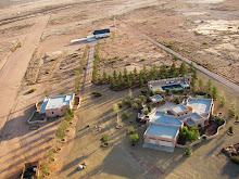
Click on the photograph to enlarge and open in a new window.
Presented on the left is an aerial image made in the pass between the Little and Big Hatchet Mountains on the east side of the bootheel in New Mexico about 12 miles west of the Mexican border as part of the bootheel photodocumentation project. On the right is the corresponding view from Google Earth. Note the similarities in the outlines around the different peaks but increased detail visible in the aerial photograph. While satellite imagery and the algorithms that allow the viewer to pan down from an overhead satellite image are very good, putting an aircraft in the same position in space and capturing an image increases the detail and information available to the viewer.


Great site, old boy.
ReplyDeleteYou and your buddies like awesome aircraft pix, humorous air tales, glamorous sky girls?
You're all more than welcome to taxi over and drop by to say hello at the top secret bunker over at the Royal Air Farce, Biggin Hill.
Warmest regards,
Wing Co
http://royalairfarce.blogspot.com/
Thanks
ReplyDelete