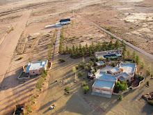
If you have looked at the San Simon Valley, where the Sky Gypsies are based, recently on Google Earth you will note that new photographs of the landscape have started appearing. By combining Aerotrekking in weight shift control aircraft with aerial photography as described in
this post it is possible to create landscape photographs of this area of the country from a unique perspective not available to many.

Photo documenting the bootheel while Aerotrekking across New Mexico. Click to enlarge.
Besides the satellite imagery and traditional view down aerial photographic information collected by the
USGS, there is little photographic information on this part of New Mexico which is one of the least visited areas of the state. Since the basin and range region is ideally suited to low level (Aerotrekking) aerial photography and with the initial success of the photography experiments expanding the project is natural.
The 1200 square miles that comprise the bootheel lies in Hidaglo county New Mexico and is part of the almost 30,000 square miles of the
Gadsden Purchase of 1854. While the bootheel proper is in Hiladgo county New Mexico and covers only a small part of the Gadsden Purchase, the expanded project includes photographs from some areas outside of the bootheel (south of I-10) but still lies within the area covered by the Gadsden Purchase. The photographic collections of the bootheel may be found
here with additional photographs
here. The current status of the project may be seen
on this map or follow the project on
Google Earth and watch as more photographs appear over time.

Entrance to Horseshoe Canyon seen while Aerotrekking in the San Simon Valley on the east flank of the Chiricahua Mountains. Click to enlarge.




 Posts
Posts