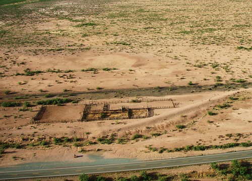
Showing posts with label aerial photography. Show all posts

Wednesday

Aerial Photography

Nothing is more fun than going for a flight and grabbing some photographs to document the experience and many pilots use only small inexpensive digital cameras on flights because of safety and ease of use.  The popularity of the digital camera has fundamentally changed how people take pictures and cameras are now built into a variety of electronic devices from smart phones to tablets, my gps even has a camera.

I was recently asked to present a digital photography workshop demonstrating how I shoot images and what processing techniques I use on the resulting photographs.  The major take home lesson from the talk was that images are no longer made in the field but rather afterward, taking pictures in the field is now a matter of  data collection.  This approach is especially useful for photographs taken while flying where quick snapshots are the rule.  If you are not satisfied with your aerial photographs perhaps applying some of these techniques will help make your photographs jump off the screen.  While I do not claim to know what makes an interesting photograph these techniques have helped garer over 500,000 views on images I created and submitted to Google Earth.

I have uploaded a pdf of the workshop power point presentation which shows how to manipulate images and lists all the software resources (free).  The pdf may be found here.

Photo book


Below is a before and after of the same image  where the input levels were slightly decreased, contrast was slightly increased, and unsharp mask was applied. Note the apparent increase in resolution and increase in photographic depth.

Tanarg image before post production processing.JPG
Before
Tanarg after post production processing.JPG
After


Sunday

Sky Gypsies Geoglyph

Like the Nazca lines in Peru, certain terrain features can only be appreciated from the air. In many cases these are man made features although nature creates many beautiful and elegant images. One of these man made creations is now visible on Google Earth. The Sky Gypsy logo created by New York artist Ben Sargent during the "Art Race" now shows up on Google Earth. The satellite image is of lower quality than that shown on the main page, but if the viewer goes to the image captured on Aug, 14 2009 the completed Sky Gypsy complex is visible as well as the geoglyph. Below is a screen capture of the satellite image from that date and below that is a low level aerial photo of the geoglyph for comparison.

Click each to open in a larger window.


Other photos of the geoglyph may be found at the Brooklyn Chowder Surfer.

Monday

More Brains

When it rains it pours. I spent a great deal of time searching for landscape that would help illustrate the idea of Gaia's Brain without any success. But then I finally found the rock outcroppings in the Animas Valley that help illustrate the idea. Then yesterday mornings flight to Playas Valley produced another location which also does the same thing. Instead of rock this brain like feature covers an area with a dark thin layer of topsoil over much lighter subsoil. The solution rills
have cut down through the topsoil into the lighter material underneath resulting in a scene resembling a 3D X-ray image of the brain.

Click on photograph to enlarge, opens in a new window.

Wednesday

The Ghost Town of Old Hachita


There are at least 2 ghost towns in the bootheel and the first one is now cataloged. Old Hachita on the east side of the bootheel sits at the base of the Little Hatchet Mountains next to Turquoise Mountain. It lies just on the east side of the contential divide and all photographic flights must cross the divide to reach the site. This link contains some background information on Old Hachita

Click on photographs to enlarge


Others have photographed Old Hachita up close, photographs of the ghost town may be found here and here and there is a 28 image Photosynth of part of the town.

Of course the fellows from emergency services made an appearence during my flight (see below) and upon returning I found Border Patrol had also visited the airport. It's good to have somebody watching your back, even if they think you are a drug smuggler.

Sunday

The Big Synth from Microsoft

The initial experiments with Microsoft's Photosynth are very promising. It appears possible to reproduce the "Big View" that weight shift control aircraft pilots have while flying. There are now 6 synths ranging from 10 to 74 images now posted at the Photosynth site. The largest is the 74 aerial photographic 3D panorama of the east flank of the Chiricahua Mountains. Taken during a series of the PTS steep bank turn maneuvers flown along the east flank of the mountain range this panorama allows the viewer to see the mountains as we see them. The software seems to run slow on this site so I would suggest viewing the synths at Microsoft's Photosynth site.

It should be possible to use the aircraft as a paint brush to paint an image with aerial photographs. If the site and flight paths were preplanned this would create 2 images, 1 the aerial panorama itself, and 2 embedded within that another form or shape visible only in the point cloud. We will see.....

Thursday

Photosynth aerial panoramic photographs, a 3D interactive experience

Translating the excitement of the aerial view from an open cock pit weight shift control light sport aircraft for others to enjoy is one of the goals here at the Sky Gypsies and from the quality and unique aerial photographs many other pilots share this vision. But creating the "Big View" photographs or PTS based panoramas (PTSPs) takes a good deal of hard work, in planning, flying, and processing. Well, there is another method that can be used to create engaging and interesting aerial panoramas without all the precision flying and processing. Microsoft has a really neat application called photosynth. It represents a different way of "seeing" and "[i]n simple terms, Photosynth allows you to take a bunch of photos of the same scene or object and automagically stitch them all together into one big interactive 3D viewing experience that you can share with anyone on the web." This is an ideal application for aerial panoramas and creating interactive flying experiences with a still camera. I have created several examples using both horizontal panorama photographs and vertical panoramas, 2 of which are presented below. (1) is a group of 17 aerial photographs of the Chiricahua Mountains, a subset of which were used to create the aerial panorama presented on Monday. While the second photosynth is of a rock outcropping east of Amigos del Cielo at the base of the Peloncillo Mountains. It should be possible to create a complete 3D view of this rock outcrop by flying and photographing it from all directions and then photosynthing the scene. Here is a link to the how to video.

Before you can view the photosynths you will be prompted to download Silverlight from Microsoft. It will download for you and just reload the page.

(1). 17 horizontal photos of the Chiricahua Mountains centered on Sulfur Canyon. 100% synthy


(2). 10 vertical photos of “The Rock” a low level fly over of a rockoutcrop. 89% synthy

Monday

Low level Aerial Panorama of Sulfur Canyon and the Chiricahua Mountains

Centered on Sulfur Canyon on the east side of the Chiricahua Mountains this panorama photograph is composed of 10 images. Taken from just above a small double hill which sits at the mouth of Sulfur Canyon (31 50' 49.35" N, 109 06' 45.66" W) and 1 mile from the cliff face, the image stretches from just south of Cave Creek Canyon on the right side of the image (north), south along the mountain range to Squaw Mountain just north of the entrance to Price Canyon, a distance of approximately 16 miles. One of the double hill hilltops is visible in the foreground at the bottom center of the low level aerial photograph giving the impression of a ground based panoramic photograph. The "steep bank turn" practical test standards maneuver was used to set the aircraft's flight path and capture the 10 consecutive images.

Chiricahua Mountains
Click here to open a larger version of the image alone on a black background.

Friday

Aerial Panorama Photographs: The Utility of the Practical Test Standard Maneuvers

I frequently hear complaints about the PTS maneuvers and it generally follows this path. Why do I have to learn these, what good are they? This is stupid, it doesn’t show that I can fly. I can do these with my eyes shut. Why can’t I go below 400’, it doesn’t matter. What do you mean, pink slip? But demonstrating precise control of the aircraft to the designated pilot examiner is one of the tools the FAA uses to ensure we are competent to fly. I have used one of the PTS maneuvers, the steep banked turn, to demonstrate why precise control is a good thing to know. One of my goals has been to translate what I see and feel when flying into pictures, videos, and words that others can relate to, to generate the desire in others to fly weight shift control aircraft. My recent experiments have centered on panoramic photographs. Now flying around in circles sounds simple but in reality to generate a panoramic photograph requires multi-tasking since both aircraft control and stable photography take place at the same time. If aircraft control consisted of flailing around the sky in some sort of circular path with changing altitudes then the photography would be impossible. A precise flight path and altitude control of the 45 degree steep bank turn is required to allow the capture of uniformly centered photographs required for the panoramic composite.

Here are 2 examples of panoramas made at the hard deck for ground reference maneuvers (400’), yes, I know 1000’ is the hard deck for performance maneuvers so I get a pink slip for flying a performance maneuver at a ground reference maneuver altitude. One panorama is looking south and one is centered on the northeast. Both were taken from the intersection of Highway 9 and 80 in the San Simon Valley just before an afternoon monsoon blew in. I was able to take the 10 or so photographs in each panorama only by precisely controlling the aircraft in the steep bank turn. So, if for no other reason than to gain the ability to make good panoramic photographs I would suggest practicing the steep bank turn, and if your in student mode here is a useful reason to learn the maneuver precisely.


I’m working on the complete 360 view but it requires a lot of computer memory and takes time to generate the panoramic images.


Looking south down the San Simon Valley, the Chiricahua Mountains on the right and the Pelocillo Mountains on the left.


Looking northest to the Peloncillo Mountains
Click photographs to enlarge and open in a new window.

Monday

Self Portrait or How it is done

They are worse than automobile drivers on cell phones, pilots with cameras that is.

Caught this image of my reflection in the GPS while photographing a Trinchera in the southern San Simon Valley at the mouth of Skull Canyon and it captures the ingredients required to make low level aerial photographs. The minimum prerequisites are calm air and good light. Calm conditions make all the difference when flying in confined areas or at low altitudes and good light makes all the difference in creating an interesting photograph. Then the photographic target is flown at series of decreasing altitudes looking for potential problems and obstacles (canyon walls, the ground, small hills, and power lines), all the while rechecking the winds and figuring out the best line past the target. Especially important is a flight path where I will have enough room to turn around once finished running the camera. Once this is worked out, I pick a line along the photographic target and do a low pass towards the target and begin shooting. This is repeated several times until I have something acceptable or I abort and come back another day and try again. I have photographed some sites numerous times because something was not correct, generally the winds. The goal is to bring back interesting views of the landscape and other features and not to fly into the ground.

On this particular flight I had to deal with a canyon entrance and high rock walls with a rocky hill in my flight path past the target. So just after taking the photographs I had to climb and turn to fly over the hilltop shown below.

Self portait

Skull Canyon entrance and rocky hill on the left, shown below in detail.
Early high test pass over rocky hill obstacle.

Friday

Desert drainages in Black and White

Here is a series of low level aerial photographs of erosion features and drainage patterns taken from an altitude of about 100' AGL from a weight shift control aircraft and treated to give the impression they are high altitude aerial photographs. They were also converted to black and white to highlight the contrast between the light and dark layers of soil. Compare the photographs below with these Space Shuttle images.


Sunday

Combining tilt shift processing with low level aerial photographic views of the desert

Flew back across the bootheel to Playas Valley this morning for some more photography. Below are several images of drainages in Playas Valley processed with tilt shift software. Most of the photographs were taken at an altitude between 50' and 100' AGL. This technique works quite well with low level images and is recommended it to anyone photographing the landscape.

Of course the Border Patrol was there as usual as backup.

Click image to enlarge


Inverted tilt shift modified desert drainage. Inverting the photograph gives the appearance the drainage's rise out of the desert floor.


Desert tilt shift


Draining the Desert

Friday

Tilt shift low level aerial photography

Tilt shift photography is an optical technique requiring a special lens. The lens is moved relative to the plane of focus resulting in images where the center is in focus and the margins are out of focus. Similar effects can be created using a large aperture and a shallow depth of field. With the advent of digital cameras and computer processing a similar effect can be created by shoving 0s and 1s around. This method is used to create tilt-shift miniatures, resulting in life size objects appearing as miniatures. In many cases high angles are also used to help create the impression of looking down on a miniature. This makes this technique especially well suited to aerial photography. Since parts of the image are defocused the photographer can draw the viewers attention to specific parts of the photograph. An online tilt shift image processing resource where the photographer can manipulate their own photographs is TiltShift maker. Several images from the Flickr site have been electronically tilt shifted and are shown below and a slideshow of tilt shift images is in the side bar near the top of the page. As you will note from the image gallery, landscapes seem best suited to this technique.

Original Aerotrekking aerial photograph
Tilt shift modified Aerotrekking aerial photograph
click to enlarge
Original photograph of Playas siding on the old El Paso and Southwestern railroad
Tilt shift modified aerial photograph of Playas siding
click to enlarge

Thursday

New Mexico’s Bootheel Photo Documentation Project

If you have looked at the San Simon Valley, where the Sky Gypsies are based, recently on Google Earth you will note that new photographs of the landscape have started appearing. By combining Aerotrekking in weight shift control aircraft with aerial photography as described in this post it is possible to create landscape photographs of this area of the country from a unique perspective not available to many.


Photo documenting the bootheel while Aerotrekking across New Mexico. Click to enlarge.

Besides the satellite imagery and traditional view down aerial photographic information collected by the USGS, there is little photographic information on this part of New Mexico which is one of the least visited areas of the state. Since the basin and range region is ideally suited to low level (Aerotrekking) aerial photography and with the initial success of the photography experiments expanding the project is natural.

The 1200 square miles that comprise the bootheel lies in Hidaglo county New Mexico and is part of the almost 30,000 square miles of the Gadsden Purchase of 1854. While the bootheel proper is in Hiladgo county New Mexico and covers only a small part of the Gadsden Purchase, the expanded project includes photographs from some areas outside of the bootheel (south of I-10) but still lies within the area covered by the Gadsden Purchase. The photographic collections of the bootheel may be found here with additional photographs here. The current status of the project may be seen on this map or follow the project on Google Earth and watch as more photographs appear over time.


Entrance to Horseshoe Canyon seen while Aerotrekking in the San Simon Valley on the east flank of the Chiricahua Mountains. Click to enlarge.

Sunday

Lake Cloverdale: An Ice Age Lake in New Mexico’s Bootheel

A number of playas can be found in the valleys of southern New Mexico and Arizona and these Pleistocene lake beds are best known as migratory bird stops. In the winter these lake beds still hold water and the shallow lakes form with the winter rains attracting many species of water fowl. In the bootheel of New Mexico there are 2 lakebeds, Lake Cloverdale and the playa that runs down the center of Playas valley.

Lake Cloverdale sits at the base of Animas valley and extends into Mexico. Covering an area of about 102 km2 (27 square miles), Lake Cloverdale is now only a grassy field with scattered cattle tanks. The shoreline of this shallow pluvial lake is clearly visible in the photographs and based on the elevation change the lake was no more than 10-20 feet deep at the margin. Several stream beds from the surrounding mountains, including Cloverdale Creek were part of the lake’s recharge system as well as springs like Cienega Springs which brought ground water into the lake. It now sits abandoned by the water as the climate dried after the last ice age and is now the largest grass landing field I can think of, although it sits on the 320,000 acre Diamond A Ranch (still known locally as the Grey Ranch).

Click to enlarge photographs


Looking south down Animas valley along the drainage toward Lake Cloverdale.


Looking southwest from the north shore of Lake Cloverdale across the former lake.

View from the south looking north at the former shoreline of Lake Cloverdale.

Looking north at the shoreline, showing the boat ramp on Lake Cloverdale.

Friday

Desert Arteries

Water is the life blood of the desert. This image from Playas Valley captures the drainage patterns which resemble the arteries and smaller arterioles in the body but here feeding the desert. This drainage leads into the Playa that runs down the center of the valley. Note the power poles for scale, or go to here to see it on the satellite map. The image is on the upper right on the satellite map.


Click to enlarge

Monday

A Threat to National Security or Another day with the Personal Emergency Services

Flew for about an hour and a half this morning in Animas Valley to take photos for the project photo-documenting the bootheel of New Mexico. As I approached highway 338 heading south from Antelope Pass there they were coming towards me driving north, the emergency crews in their trucks, or were they Border Patrol, they were Border Patrol. I waved as I passed them and flew south down 338 at various altitudes getting photographs of the scenery and prominent landmarks for this project. The further south I flew the more Border Patrol vehicles I saw. As I passed each Border Patrol Vehicle I waved and when I looked behind me there they were, following me down the valley. They had dutifully turned around and were following along. My airspeed was about 70 and they started to fall behind. The highway turns to dirt partway down the valley and they fell further back once they were driving on the dirt road. I reached the Pleistocene Lake Cloverdale and dropped low for photographs of the paleo shoreline and the surrounding hills. I finished up and climbed back up a little ways and started heading back north. There in the distance were several plumes of dust from the dirt road, the emergency service vehicles had yet to catch up. I'm certainly glad I did not have any problems while photographing the Ice Age Lake Cloverdale, I would have had to wait a good while for them to reach me. I passed them still going south as the aircraft was headed north. I looked back again and they had turned around and were now all headed north. When I landed I mentioned the Border Patrol following me and found out a call from Home Land Security in Washington had been made. They want to know if I'm a legitimate target they can launch assets against. I never considered myself a particular threat to anyone but if they want to spend money "launching assets" from Washington against a weight shift control aircraft that is their business, I'm just photographing the countryside. I did feel safer with the Border Patrol following me around, but now I guess I will have to look out for flying "assets" in addition to other air traffic.

The final photos from the bootheel will appear on Flickr and at some point may appear on Google Earth.


Click to enlarge

Saturday

A Different Kind of Aerial Photography: Low Level Images From Weight Shift Control Aircraft

Creating meaningful images takes time, patience, and skill, and the submitted results visible on the various photograph hosting sites like Flickr attest to the creativity of photographers all over the planet. But as human beings we are limited to the creating photographs within about 6 feet of the ground and generally within walking distance of our car and this is reflected in the type and distribution of photographs in appearing in Google Earth and on other maps. Generally, the more energy required to capture an image the less likely someone will create the it and share it. People push the boundaries by driving till the road ends then hiking up mountains, standing on cliff edges, or hanging off ropes, all in an effort to capture a unique image but there are additional limitations in photographing many areas of the country, primarily access. Land ownership prevents many from going where photographic opportunities exist. Landowners, especially in the west, jealously guard access to their property even if the photographer is only crossing to access public lands. But while the land maybe owned by an individual, the airspace is not. Rather it is regulated by the Federal Government and belongs to no individual and best of all it starts just above the dirt. A number of photographers use the freedom of the skies to capture images from the air and have produced some beautiful photographs.

All kinds of aerial platforms are used to capture images from kites and balloons, to helicopters and fixed wing general aviation aircraft but the generated images all share one thing in common, they are views looking down. They exploit the advantage of height to capture a larger panorama or a perspective not visible from the ground. I have made plenty of these types of images and the advantage of elevation certainly provides a unique perspective. But why are these images made, what is the goal of the image? Is it Art or is the goal descriptive, to relate to the viewer what the photographer sees from their vantage point in the aircraft? As Art the emotional response the image provokes is important and dictates the view. As a descriptive tool aerial photographs are just that views from “on high”. I have taken a different approach with many of my aerial photographs. Instead of Art or a pure descriptive approach I have been creating aerial photographs taken from places difficult to access. The goal is to create an image that could have been taken from the ground but was not.

Using open cockpit weight shift control aircraft light sport aircraft, affectionately known as trikes, a photographer can place the camera anywhere from 6 feet up. In addition a photographer can place the camera view on any spot not easily accessible to the ground based photographer creating either landscape photographs or up close shots of specific subjects without trespassing and becoming the immediate recipient of a landowners wrath. In other words low level aerial photography at the interface between the ground and sky. For example, the photograph of Animas New Mexico shown below was taken near the top of a local hill on private land. Instead of tracking down the landowners and gaining access through locked gates then climbing the hill, the aircraft was flown at hilltop height passing a wing over the hill top to capture the photograph.

Compare the Google Earth view with the photographed image. The Google Earth image is shown higher and somewhat back to show the top of the hill used as the geographic location for the photograph. The rotated satellite image from the hill top is the same as the captured photographic image.


Image courtesy of Google Earth.


Or this view of Granite Mountain north of Granite Gap New Mexico. The view is horizontal as though taken from atop one of the rock outcroppings but was taken above the terrain from the aircraft.

Images taken in this manner will have the characteristic horizontal or upward and are indistinguishable from a photograph taken from the ground but provides more information and is pleasing. In addition to the ground based perspective all the images created are designed to be viewed on the computer screen and not printed. With so many professional photographers producing creative content there is no expectation that any of the images will ever be printed. So I strive to make the images that view well in a small format on the computer screen. As such the photographs are viewed on several different computer screens and only those chosen which provide the viewer with the best overall effect.
Sunday

Cerro de Trincheras in the San Simon Valley

The San Simon Valley has been a cross roads for a number of cultures and evidence of their occupation can be found along the length of the valley. One of the more enigmatic and less understood sites found in New Mexico, Arizona, and northern Mexico are walled hilltops. These Cerro de Trincheras or fortified hills were first recognized in the late 1800's. The best known and investigated of the Trincheras is Cerro de Trincheras, located in northern Sonora Mexico. The site can be seen from over 25 miles away, is composed of over 900 north facing terraces, and was occupied between 1300-1500 CE. Of those sites analyzed, occupation of the Trincheras occurred in 3 phases. The oldest site was occupied about 1000-800 BCE, then several from a period of around 200-500 CE, and a final phase of construction and occupation around 1300-1500 CE. The Trincheras phenomena are not isolated temporally or spatially occurring over a period of 2500 years and over an area of 50,000 square miles. As such they may represent the work of the local agrarian peoples. The function of these sites is somewhat controversial but the it has been suggested that they served as:

1. Refugia created by the locals to protect their harvests from other groups.
2. Village sites.
3. Communication centers, based on hilltop locations.
4. Specialized centers for public events and ceremonies.
5. Terraced gardens.

While Arizona and Mexico have the highest density of Trincheras, several are known from New Mexico. This site was discovered on a flight from the Sky Gypsies complex at Amigos del Cielo airpark, aerial photograph 1. The hill rises 20 meters from the surrounding valley floor and the walled hilltop has a well defined outer wall and fainter inner wall, aerial photographs 2 and 3 . The outer oval wall encloses an area 68 x 52 meters, while the inner circle is about 30 meters in diameter. Inside the inner wall there are at least a dozen round rooms discernible, some created using existing rock outcrops, aerial photograph 4.

Who was responsible for the construction of this particular Trincheras and its function await further archeological studies.

Aerial photograph 1

Aerial photograph 2

Aerial photograph 3

Aerial photograph 4

Click to enlarge

Aerial photographs of other Trincheras may be found here and here. A description of Cerro Juanaquena a Trincheras site in northern Mexico may be found here.

Friday

The One Percent, it Worked

Well, back at it and this time we were successful. Another afternoon taking pictures, better conditions and a different location.


Click to enlarge

If you want a copy head over the the Flickr site and download the image, it is under a Creative Commons license, meaning you are free to use the image for noncommercial purposes just give credit or better yet a link. Click on the slide show under "steal these weight shift aerial pictures" in the side bar to get over to Flickr.

Thursday

The One Percent

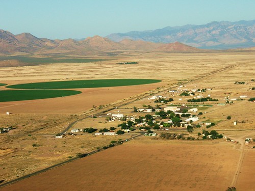
You spend an afternoon hiking around the desert looking for that great scene, you recruit someone to help, you preflight the aircraft and it goes from dead calm to 10-15. But your after the shot so off you go, expecting mechanical turbulence you watch everything very carefully. You add extra energy since you will be low. Your friend fires off the camera and you go around and around for shot after shot till your arms tire. Did we get anything? Well the best result is shown below with the aircraft hiding behind a bush. Only about 1% of the aerial photographs really work out. It doesn’t matter what you do it will always be 1%. So when you see those pretty aerial photographs, remember you are looking at the 1%.
Click to enlarge.