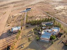
Since the start of the space age in 1957 the public has been fascinated by views of the earth from above and NASA has complied with the publication of satellite imagery, first as black and white images and now as false color images. The USGS maintains a website that is devoted to displaying Landsat-7 images of the earth. The Earth as Art has a number of satellite images which are in and of themselves are art.
Compare the following image pairs, in the 4 sets the first image is a landsat-7 or space station image taken from orbit and the second image is a low level aerial photograph taken from less than 200 feet AGL. Note the lack of scale in the low level aerial image creates the impression the low level images were taken from high altitude. Without suitable references the brain interprets the images placing them in a familiar category, namely high altitude images. Fifty feet or 150 miles it's all the same, it's turtles all the way down.
DesolationCanyon

Low level aerial photograph View On Black
Guinea-Bissau

Low level aerial image
West Fjords, Iceland

Low level aerial image

Seoul, South Korea
Cities from Space, a low level aerial image


No comments:
Post a Comment