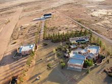
There has been some discussion ( here and here) about the use of the iphone to track flights which can then be saved and shared. This is a great idea but it can be made even better. What about adding photographs and video? Google maps allows users to create their own maps and add information, the final product can be either private (don‘t want to share the location of your favorite spot with the world) or public (everybody wants to fly there). Here is a sample map of sights in the San Simon Valley I created with a 110 mile flight route to the major sights and photographs of those places, I’ve even thrown in a couple of videos (you can also geotag your new videos on YouTube during uploading to correspond with your map).
View Flying in the bootheel, the San Simon Valley in a larger map
Here is the YouTube tutorial on creating maps.
The integration of photographs and videos with Google maps and the ability to place a flight path connecting the locations seems like a useful tool for pilots who want to share their flights.
Subscribe to:
Post Comments (Atom)


No comments:
Post a Comment