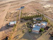
I was recently asked to present a digital photography workshop demonstrating how I shoot images and what processing techniques I use on the resulting photographs. The major take home lesson from the talk was that images are no longer made in the field but rather afterward, taking pictures in the field is now a matter of data collection. This approach is especially useful for photographs taken while flying where quick snapshots are the rule. If you are not satisfied with your aerial photographs perhaps applying some of these techniques will help make your photographs jump off the screen. While I do not claim to know what makes an interesting photograph these techniques have helped garer over 500,000 views on images I created and submitted to Google Earth.
I have uploaded a pdf of the workshop power point presentation which shows how to manipulate images and lists all the software resources (free). The pdf may be found here.
| Photo book |
Below is a before and after of the same image where the input levels were slightly decreased, contrast was slightly increased, and unsharp mask was applied. Note the apparent increase in resolution and increase in photographic depth.
| Before |
| After |


You are so artist in your computer work! I am waiting for a day when you can go fly and take some more pictures from the air!
ReplyDeleteSame here, thanks.
ReplyDelete