
All kinds of aerial platforms are used to capture images from kites and balloons, to helicopters and fixed wing general aviation aircraft but the generated images all share one thing in common, they are views looking down. They exploit the advantage of height to capture a larger panorama or a perspective not visible from the ground. I have made plenty of these types of images and the advantage of elevation certainly provides a unique perspective. But why are these images made, what is the goal of the image? Is it Art or is the goal descriptive, to relate to the viewer what the photographer sees from their vantage point in the aircraft? As Art the emotional response the image provokes is important and dictates the view. As a descriptive tool aerial photographs are just that views from “on high”. I have taken a different approach with many of my aerial photographs. Instead of Art or a pure descriptive approach I have been creating aerial photographs taken from places difficult to access. The goal is to create an image that could have been taken from the ground but was not.
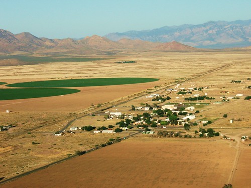
Using open cockpit weight shift control aircraft light sport aircraft, affectionately known as trikes, a photographer can place the camera anywhere from 6 feet up. In addition a photographer can place the camera view on any spot not easily accessible to the ground based photographer creating either landscape photographs or up close shots of specific subjects without trespassing and becoming the immediate recipient of a landowners wrath. In other words low level aerial photography at the interface between the ground and sky. For example, the photograph of Animas New Mexico shown below was taken near the top of a local hill on private land. Instead of tracking down the landowners and gaining access through locked gates then climbing the hill, the aircraft was flown at hilltop height passing a wing over the hill top to capture the photograph.
Compare the Google Earth view with the photographed image. The Google Earth image is shown higher and somewhat back to show the top of the hill used as the geographic location for the photograph. The rotated satellite image from the hill top is the same as the captured photographic image.

Image courtesy of Google Earth.
Or this view of Granite Mountain north of Granite Gap New Mexico. The view is horizontal as though taken from atop one of the rock outcroppings but was taken above the terrain from the aircraft.
Images taken in this manner will have the characteristic horizontal or upward and are indistinguishable from a photograph taken from the ground but provides more information and is pleasing. In addition to the ground based perspective all the images created are designed to be viewed on the computer screen and not printed. With so many professional photographers producing creative content there is no expectation that any of the images will ever be printed. So I strive to make the images that view well in a small format on the computer screen. As such the photographs are viewed on several different computer screens and only those chosen which provide the viewer with the best overall effect.


Beautiful views of aerial photography,.
ReplyDeletesearchexpert