Saturday

Google versus Life


Click on the photograph to enlarge and open in a new window.

Presented on the left is an aerial image made in the pass between the Little and Big Hatchet Mountains on the east side of the bootheel in New Mexico about 12 miles west of the Mexican border as part of the bootheel photodocumentation project. On the right is the corresponding view from Google Earth. Note the similarities in the outlines around the different peaks but increased detail visible in the aerial photograph. While satellite imagery and the algorithms that allow the viewer to pan down from an overhead satellite image are very good, putting an aircraft in the same position in space and capturing an image increases the detail and information available to the viewer.

Wednesday

High Altitude or Low Altitude Aerial Images? Or the Big Picture versus the Little Picture

At the bottom of this page is a slideshow "Desert Drainages" containing images of various erosion and drainage features, rills, found around the bootheel of New Mexico that have been photographed from an open cockpit weight shift control light sport aircraft at very low altitudes, anywhere from about 20 feet (low pass) to 200 feet. These features have have a number of things in common but he most important commonality is the lack of discernible scale to help the viewer interpret the size of individual features in the photograph. These images are primarily oblique view low level aerial photographs, as opposed to ground based horizontal views, and the lack of scale and camera angle leads to confusion as the brain tries to fit the image into a known category.

Since the start of the space age in 1957 the public has been fascinated by views of the earth from above and NASA has complied with the publication of satellite imagery, first as black and white images and now as false color images. The USGS maintains a website that is devoted to displaying Landsat-7 images of the earth. The Earth as Art has a number of satellite images which are in and of themselves are art.

Compare the following image pairs, in the 4 sets the first image is a landsat-7 or space station image taken from orbit and the second image is a low level aerial photograph taken from less than 200 feet AGL. Note the lack of scale in the low level aerial image creates the impression the low level images were taken from high altitude. Without suitable references the brain interprets the images placing them in a familiar category, namely high altitude images. Fifty feet or 150 miles it's all the same, it's turtles all the way down.


DesolationCanyon


Low level aerial photograph View On Black


Guinea-Bissau


Low level aerial image


West Fjords, Iceland


Low level aerial image


Seoul, South Korea


Cities from Space, a low level aerial image

Monday

More Brains

When it rains it pours. I spent a great deal of time searching for landscape that would help illustrate the idea of Gaia's Brain without any success. But then I finally found the rock outcroppings in the Animas Valley that help illustrate the idea. Then yesterday mornings flight to Playas Valley produced another location which also does the same thing. Instead of rock this brain like feature covers an area with a dark thin layer of topsoil over much lighter subsoil. The solution rills
have cut down through the topsoil into the lighter material underneath resulting in a scene resembling a 3D X-ray image of the brain.

Click on photograph to enlarge, opens in a new window.

Friday

Everybody Aerotrekks

Everybody goes Aerotrekking at some time or another, even the government is using the technique to monitor rangelands. The USDA Rangeland Research Unit is using light sport aircraft and low level aerial photography to monitor the health of rangelands and compliance with revegetation projects in western states. A 5 year project, Vegetative Monitoring of Rangelands Using Low-Level Aerial Photography is using a light sport aircraft to monitor and quantify changes in grassland in response to grazing and activities associated with oil and natural gas recovery.

In a comparison of techniques it was found that there was no statistical difference between laser-point frame imagery, 2m AGL imagery, and low level aerial photography (100m AGL imagery) methodologies in the pooled dataset. In fact the Standard Deviation, corrected sums of squares, COV, and SE were all less than half of the laser-point method and less than the other methods as well. The authors conclude that “The reduction in cost per sample, the increased speed of sampling, and the smaller standard deviation associated with the 100-m AGL digital imagery are compelling arguments for adopting this vegetation sampling method.”

Here is an article on the application of the technique for Riparian monitoring using 2-cm GSD aerial photography in the journal Ecological Indicators

Project Summaries using low level aerial photography
Low Altitude, High-Resolution Digital Aerial Photography, and Computer Enhanced Data Analysis for Monitoring Rangeland Resources is a project to examine different land management regimes and quantify their effect on the ecological resources.

Ground and Aerial Analyses of the Vegetation in Selected Allotments of the Grand River and Missouri National Grasslands

RANGELAND ECOSYSTEMS: CHARACTERIZATION, MANAGEMENT, AND MONITORING

People can come up with the strangest excuses to go Aerotrekking, but I’m glad to see the scientific community realizing the utility of light sport aircraft for low level aerial photography, data acquisition, and monitoring.

Wednesday

Paleo Runway Discovered: Off Topic Post

Artist conception from Wikipedia.

This article in Yahoo News Announced "[a] prehistoric runway for flying pterosaurs has been discovered for the first time". Evidence of a landing pterosaur was found in fine grained limestone from a 140 million year old beach in southwestern France. The flying reptile apparently touched down, hopped, and then came to rest on all fours on the beach before wandering off. Like weight shift pilots the reptile flew down then slowed (bled off airspeed) until stalling just at landing.

It is good to know the principles of aerodynamics were applicable back in the Jurassic.

Monday

Gaia's Brain: Low Level Aerial Photosynth

Just finished a 76 image photosynth of Gaia's Brain (see preceding post). It took 2 flights to get the photographs and Microsoft's Photosynth to make sense of them. On the second flight 2 Border Patrol trucks were waiting for me. I dropped low and grabbed this photograph, waved, and start gathering photographs for this photosynth. There's me flying in circles photographing rocks and the Border Patrol watching. Kinda like watching grass grow, it could not have been very exciting. But I do like having the backup.


Here is the final product, there are at least 2 halos I've found indicating that I managed fairly good coverage of Gaia's Brain. You may also view Gaia's Brain on BAlvarius' page at the photosynth site where a larger version is available. While the original "Gaia's Brain" black and white tilt shift photographs may not appear to be aerial photographs the photosynth should put to rest any doubt (and I have witnesses).


A simple multi-image panorama may be seen here.

Saturday

Gaia's Brain

The idea for an image of Gaia's Brain has been floating around for awhile and several flights were made trying to capture an image that would serve as its basis, but none of the proposed sites for the photograph produced anything publishable. After much work I got the aircraft in the right place, at right time of day, at the right altitude, and right angle to bring the idea to life. Taken from an altitude of between 50' and 100', the photograph is of exposed bedrock that is highly fractured, weathered, and eroded. The eroded rounded bedrock has the appearance of the convolutions found on the surface of the brain and by processing the image with tilt shift software and presenting it in black and white this effect is highlighted.

By presenting an image suggesting a physical brain and implying that it can be localized (to the bootheel of New Mexico), the photograph reiterates some of the early ideas about he anthropomorphic nature of the Gaia hypothesis that were very controversial. Primarily, that planetary homeostasis and the feedback loops that maintain it requires an underlying intelligence to create and maintain the system. Evidence suggests otherwise.


Click on photograph to enlarge and open in a new window, but the image looks best when Viewed On Black


View on Black

Thursday

Low level Aerial Photography: A Comparison of Techniques

There are several more aerial panoramas of the Chiricahua and Peloncillo Mountains that were captured during low level flights now available for viewing. They are hosted at Photobucket and may also be found at the bottom of this page. In a comparison between multi image panoramas and Microsoft's Photosynth, evaluating the images ability to translate the view from the cockpit (a qualitative measure to be sure), the large images created with Photosynth appear superior since they are not subject to the viewpoint distortion seen in large multi image panoramas. This apparent difference results from Photosynths ability to incorporate single images captured from multiple locations around the target and present them in the final product. The drawback is of course the requirement for additional viewing software (which is free and loads automatically) and is a minor inconvenience when compared with the ability to navigate around an object.

sulphur canyon aerial panorama

Sulphur Canyon rotating to the north

Chochise Head

Tuesday

Cerro de Trincheras Update

The fortified hilltop or Cerro de Trincheras discovered just north was rephotographed to create a Photosynth. While the photosynth of Paramore Crater represents an "inside out" viewing perspective the completed photosynth of the Cerro de Trincheras is an example of the reverse or an "outside in" perspective. The synth is a compailation of photographs taken over 3 flights and allows the viewer to navigate around the hill and view the Trincheras from all sides.

Monday

Snuggling no Smuggling Babies

Well, my tongue in cheek suggestion based on Jonathan Swift’s “A Modest Proposal” appears to be a growing statistic. According to the Arizona Republic, smuggling small children is a growing business in border areas. The frequency of smuggling small children has increased to the point where “[t]he U.S. Attorney's Office was so alarmed by the trend that in March 2007, the agency announced a concerted effort to pursue the harshest penalties for suspected child smugglers. Sentences since then have averaged about 15 months in federal prison.”

Still from a cost benefit anaylsis, 15 months versus years for drug smuggling, smuggling babies in trikes still makes this a viable alternative.

Thursday

Intercepted or a Visit From the Expanded Aerial Emergency Services.

On the flight yesterday morning, about 10 minutes after takeoff, the aerial wing of the expanded emergency service showed up. My flight was intercepted by a Border Patrol helicopter which came from behind and passed over and close by the right wingtip. I responded by calling on the air to air frequency to make contact and ask them to stand off but received no response. Wake turbulence from helicopters can be unpredictable and could affect the flight path of a weight shift light sport aircraft. Fortunately, the helicopter made a single pass then started to head off. I only managed to get a single photograph of the departing helicopter since I was busy first trying to first contact them, then getting the camera out and turned on. What is interesting is the speed at which they showed up. I was 40 miles from Lordsburg, the closest facility with avgas so they were either already in the area at 7:00 AM or they are hiding the helicopter somewhere down in the bootheel. In either event it is good to have someone watching your back. I will test the hypothesis that they are parking the helicopter somewhere down here by flying again in the early morning and see if they quickly show up. If they are down here with the helicopter I would expect them to show up at least once every flight in the bootheel.


Departing Border Patrol helicopter

Wednesday

The Ghost Town of Old Hachita


There are at least 2 ghost towns in the bootheel and the first one is now cataloged. Old Hachita on the east side of the bootheel sits at the base of the Little Hatchet Mountains next to Turquoise Mountain. It lies just on the east side of the contential divide and all photographic flights must cross the divide to reach the site. This link contains some background information on Old Hachita

Click on photographs to enlarge


Others have photographed Old Hachita up close, photographs of the ghost town may be found here and here and there is a 28 image Photosynth of part of the town.

Of course the fellows from emergency services made an appearence during my flight (see below) and upon returning I found Border Patrol had also visited the airport. It's good to have somebody watching your back, even if they think you are a drug smuggler.

Sunday

Aerotrekking Reaches a New Low

It's finally been done, aerotrekking below ground level. A weight shift control light sport aircraft flew inside Paramore Crater in southeastern Arizona and it was all part of the bootheel photodocumentation project. The goal was to create a a 360 degree panoramic photosynth starting below ground level and then rising up allowing the viewer to see the surrounding countryside. Composed of 119 separate images taken from close to the bottom of the crater and rising in a counter clockwise spiral this synth provides the viewer with a perspective never before captured.

Paramore Crater, officially a maar, was the result of an explosive basaltic blast and is part of the Quaternary aged (3.2 - 0.2 mya) Geronimo lavas that cover approximately 850 sq km the northern part of the San Bernardino Valley. It is surrounded the tuff ring outside of the crater and is the larger of 2 maars located in the valley.

Compare the single image photographs with the final photosynth product below them. The amount of information the photosynth conveys is orders of magnitude greater than any set of photographs. Placing and viewing the overlapping photographs in their proper relationship to one another allows the viewer to move within the photograph viewing different objects in the scene. It is another example of the importance of relative motion.

Topographic map with 10' contour intervals. Compare the topographic map with the photosynth and note there is not the distortion seen with low level aerial panoramas.
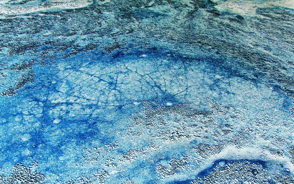
Crater wall, tuff ring, and erosion.
Crater wall, tuff ring, and distant hills.


Paramore Crater Photosynth. This is best viewed here, it will be in a larger format.