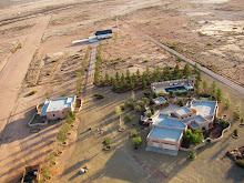
Paramore Crater, officially a maar, was the result of an explosive basaltic blast and is part of the Quaternary aged (3.2 - 0.2 mya) Geronimo lavas that cover approximately 850 sq km the northern part of the San Bernardino Valley. It is surrounded the tuff ring outside of the crater and is the larger of 2 maars located in the valley.
Compare the single image photographs with the final photosynth product below them. The amount of information the photosynth conveys is orders of magnitude greater than any set of photographs. Placing and viewing the overlapping photographs in their proper relationship to one another allows the viewer to move within the photograph viewing different objects in the scene. It is another example of the importance of relative motion.
 Topographic map with 10' contour intervals. Compare the topographic map with the photosynth and note there is not the distortion seen with low level aerial panoramas.
 Crater wall, tuff ring, and erosion.
 Crater wall, tuff ring, and distant hills.
Paramore Crater Photosynth. This is best viewed here, it will be in a larger format.


thanks very much for your large information .and knowledge full description . i think it is sus a topi that many kinds of people face many problem. thanks for this.
ReplyDeleteInformation visualization Low