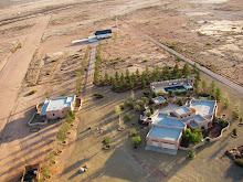
Google hosts the Sky Gypsies blog and Goggle Earth is the repository for many of the low level aerial images of New Mexico's bootheel created from weight shift control light sport aircraft. In fact Google Earth is routinely used to design low level aerial photographs using the tilt down feature. I have written
several postings about the utility of Google Earth and how to create
low level aerial photographs to enhance the viewers experience. It appears that now the Google folks are getting into the idea themselves.
In this article and
this article, Google is reportedly testing a small aerial drone with photographic capabilities. The article suggests that the inclusion of low level aerial images would complement the satellite images and street views available on Google Earth and Google maps. I fully agree and I went so far as to submit a proposal to them, see text below. It was also partial impetus for the creation of the
bootheel photodocumentation project, which brings together a number of the aerial images from the multi-image aerial panoramas (big picture) to the low level pictures of erosion features (the little picture) in a demonstration of what can be achieved with weight shift control light sport aircraft.
While the battery powered quadcopter can stay up for an hour gathering data I would like to point out that only a pilot with a photographers eye can find the great shot and then place the aircraft in a position to get the picture. That takes planning but also a good deal of moving the aircraft around while looking at the scene from a number of different angles to get the right view. While 2 people (a pilot and a photographer) may be able to coordinate their activities a single person can do the job faster, easier, and get the aircraft into areas ground based personnel can not reach. Finally, a word of advice, the coolest aerial photographs are those taken either looking out or looking up at ground based features.
Draft of proposal submitted
Creating meaningful images takes time, patience, and skill, and the submitted results visible on Google Earth attest to the creativity of various photographers. But as human beings we are limited to the creating photographs within about 6 feet of the ground and generally within walking distance of our car. We circumvent this limitation by climbing buildings or any structure to get a better view, or by driving till the road ends then hiking up mountains, standing on cliff edges, or hanging off ropes, all in an effort to capture a unique image. But there are severe limitations in accessing many areas of the country. Land ownership prevents many from going where photographic opportunities exist. Landowners, especially in the west, jealously guard access to their property even if the photographer is only crossing to access public lands. But while the land maybe owned by an individual, the airspace is not. Rather it is regulated by the Federal Government and belongs to no individual and best of all starts just above the dirt.
Using open cockpit weight shift control light sport aircraft, affectionately known as trikes, a photographer can place the camera anywhere from 6 feet on up. In addition by flying low (within the regulations) they can place the camera view on any spot not accessible to the ground based photographer creating either landscape photographs or up close shots of specific subjects without trespassing and becoming the immediate recipient of a landowners wrath.
So how does Google Earth fit in with this “extremely low flying aircraft as a tripod” approach to photography? Well, it can be stated in a single word, composition. Flying around looking for the right scene rapidly becomes time and cost prohibitive, but with Google Earth and high resolution satellite imagery it is possible to design a landscape photograph before every going outside. Time spent working with Google Earth and the tilt down feature allows the photographer to test different camera placements from the flats of the valley to inaccessible hilltops and get an idea if there is a hidden photograph waiting to be captured from that vantage point. If so, it then becomes a matter of flying to the spot and placing the aircraft at the altitude of the hilltop or close to the ground and then capturing the image. That is not to say it is an easy task using a light sport aircraft as a tripod. There are still all the usual photographic considerations such as lighting which must be accounted for. In addition, piloting an aircraft and taking photographs takes some expertise especially in tight quarters. Weather also plays a major factor, winds can move the aerial tripod in different directions ruining a shot. But the amount of time and energy saved in preplanning photographs using Google Earth is well worth the effort.
This is not aerial photography in its strict sense. The idea here is to place the aircraft in a spot normally inaccessible to ground based photographers and capture an intriguing image with the goal of creating images that could have been taken from a particular spot in a conventional manner but weren’t. For example,
this photograph was taken from a height of about 75 feet, well below the surrounding hilltops, and captures Granite Peak from an unusual angle. It is 1 of 3 photographs made of Granite Gap and accepted at Google Earth. Or this photograph of Animas New Mexico was taken from the top of a local hill.
So by first using Google Earth to compose photographs then placing an aerial tripod in remote or inaccessible places it is possible to create scenic landscape photographs that have a much higher probability of success.


