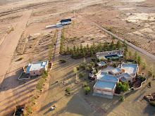
Everyone has at least a passing familiarity with Google Earth. I use it frequently for flight planning since I fly VFR and it is especially useful when planning a video. I can get an idea of how the terrain looks from various altitudes and angles so I know how to position the camera and aircraft during filming for the best effect. Google incorporates submitted photographs into the map and you can find pictures of about everything on the map including naked people photographed from space. I had submitted a number of photographs taken while Aerotrekking and 25 have been accepted for inclusion on the map. All are from local flights and include some of the places around here. You can see the whole collection here or watch them in the sidebar. I have several photographs that are still under review and I plan on adding additional photographs from around the boot heel.
The photograph of the ninth hole at GPGC was taken by Dan Murphy. I just prepped the photo and submitted it. He tells me his course is free but it's $50.00 a ball.
Friday
Subscribe to:
Post Comments (Atom)


No comments:
Post a Comment