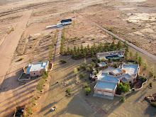
Translating the excitement of the aerial view from an open cock pit weight shift control light sport aircraft for others to enjoy is one of the goals here at the Sky Gypsies and from the quality and unique aerial photographs many other pilots share this vision. But creating the "Big View" photographs or PTS based panoramas (PTSPs) takes a good deal of hard work, in planning, flying, and processing. Well, there is another method that can be used to create engaging and interesting aerial panoramas without all the precision flying and processing. Microsoft has a really neat application called photosynth. It represents a different way of "seeing" and "[i]n simple terms, Photosynth allows you to take a bunch of photos of the same scene or object and automagically stitch them all together into one big interactive 3D viewing experience that you can share with anyone on the web." This is an ideal application for aerial panoramas and creating interactive flying experiences with a still camera. I have created several examples using both horizontal panorama photographs and vertical panoramas, 2 of which are presented below. (1) is a group of 17 aerial photographs of the Chiricahua Mountains, a subset of which were used to create the aerial panorama presented on Monday. While the second photosynth is of a rock outcropping east of Amigos del Cielo at the base of the Peloncillo Mountains. It should be possible to create a complete 3D view of this rock outcrop by flying and photographing it from all directions and then photosynthing the scene. Here is a link to the how to video.
Before you can view the photosynths you will be prompted to download Silverlight from Microsoft. It will download for you and just reload the page.
(1). 17 horizontal photos of the Chiricahua Mountains centered on Sulfur Canyon. 100% synthy
(2). 10 vertical photos of “The Rock” a low level fly over of a rockoutcrop. 89% synthy
Subscribe to:
Post Comments (Atom)


No comments:
Post a Comment