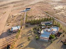
 Building foundations at the Rodeo Intermediate Field
The Rodeo Intermediate Field is the oldest airport facility in the San Simon Valley and deserves some recognition. To that end I started the application process for a historical marker at the site. The first hurdle was getting the site listed in Geographic Names Information System. It seems that the intermediate field had never been listed. So I submitted the site with the 1936 facilities directory showing the listing for the facility. The only problem was the lat/long given in the facilities directory was incorrect and placed the intermediate field in the Chiricahua mountains. After sending in aerial photographs and screen captures from Google Earth the true location of the intermediate field was accepted and the site was listed.
Then the next step in the process was more research, drawing together all the available information on the site for submission to the New Mexico State department that oversees the placement of historical markers. A statement for the historical marker was written and submitted with the supporting research. Now the application will have to be voted on by a committee and this occurs next month. Below is the text of the application with the suggested rewrites. We'll find out the middle of next month whether they will place a marker. If so, it will be the third historical marker in the county.
Official Scenic Historic Marker Program
CPRC meeting: October 15, 2010
Name of Marker: Rodeo Intermediate Field, CAA 57A
County: Hidalgo
Review: Original Text/Replacement Marker Revised Text
Move of Existing Marker XX New Marker
NMDOT District: District 1
NMDOT Highway: near intersection of US 80 and NM 9
Existing or Proposed Text:
Developed by the U.S. Department of Commerce, the CAA intermediate field system supported early commercial aviation across the nation. The Rodeo Intermediate Field (CAA 57A) was established in 1930 to support early air traffic from the west coast and El Paso and served as an Army’s Auxiliary field during WWII.
Word Count: 50
Suggested Rewrite, tsd:
Developed by the U.S. Department of Commerce, the intermediate field system greatly increased safety in early commercial aviation. Civil Aeronautics Authority field 57A was established in 1930 to support air traffic by Standard Airlines — later TWA — from California to El Paso and served as an Army Auxiliary field during WWII. Its earthen air strips, a directional arrow pointing the way to El Paso and building foundations still are visible.
Word Count: 69
Previous Title and Text: N/A
Source(s):
http://geonames.usgs.gov/pls/gnispublic/f?p=139:3:43738547032407::NO:3:P3_FID,P3_TITLE:2507807%2CRodeo%20Intermediate%20Field%20%28historical%29
http://www.members.tripod.com/airfields_freeman/NM/Airfields_NM_SW.htm
http://wikimapia.org/15214173/Rodeo-Intermediate-Field
http://www.panoramio.com/photo/21064668
http://s890.photobucket.com/albums/ac110/BAlvarius/Tilt%20shift%20aerial%20photographs/?action=view¤t=rodeobeaconhill.jpg¤ttag=Intermediate%20field
http://wiki.worldflicks.org/rodeo_intermediate_field.html#coords=%2831.932078,-108.99238955%29&z=15
http://www.airforcebase.net/aaf/if_list.html
http://www.airfieldsdatabase.com/CAA/CAA%20R19a%20NM-WY.htm
Text Approved by CPRC on Date:
CPRC Comments:
For Referral to:


I noticed you have a link to my website. Great. There is a lot of data there about the Rodeo CAA site as it had an earlier name "Pratt". I have the documentation about its history in the remarks column. It started under the name Pratt and then changed to Rodeo.
ReplyDelete