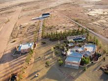
Sulphur Canyon rotating to the north
Thursday
Low level Aerial Photography: A Comparison of Techniques
There are several more aerial panoramas of the Chiricahua and Peloncillo Mountains that were captured during low level flights now available for viewing. They are hosted at Photobucket and may also be found at the bottom of this page. In a comparison between multi image panoramas and Microsoft's Photosynth, evaluating the images ability to translate the view from the cockpit (a qualitative measure to be sure), the large images created with Photosynth appear superior since they are not subject to the viewpoint distortion seen in large multi image panoramas. This apparent difference results from Photosynths ability to incorporate single images captured from multiple locations around the target and present them in the final product. The drawback is of course the requirement for additional viewing software (which is free and loads automatically) and is a minor inconvenience when compared with the ability to navigate around an object.
Sulphur Canyon rotating to the north
 Chochise Head
Sulphur Canyon rotating to the north
Subscribe to:
Post Comments (Atom)


No comments:
Post a Comment