
Tuesday
Monday
Slow Flight
Passing the check ride for a Sport Pilot License requires the performance of a number of flight maneuvers completed according to FAA standards. Below is an image of a natural pilot caught doing slow flight. Really it is the result of a slower shutter speed as a result of the dim viewing conditions but perfectly captures the blur of the wings while maintaining the head in focus. So for those practicing their PTS maneuvers getting ready for a check ride, this is for you.
 |
| A slow shutter speed captures a Blue bird in "slow flight". |
Wednesday
A little more Aviation History from this corner of the Desert
The history of aviation in this little corner of the desert southwest is truly amazing. From the early Rodeo Intermediate Airfield to more modern uses of aircraft in the valley aviation has influenced the area since its' inception. I recently came across this image taken at the Douglas Fairgrounds, circa 1910, of an early monoplane constructed locally. Probably built by the Douglas flying club it shows several men including W. K. Morrow (in the bowler hat) whose family ranched in the Chiricahuas for many years. Just reinforces the notion that aviation still has a place here.
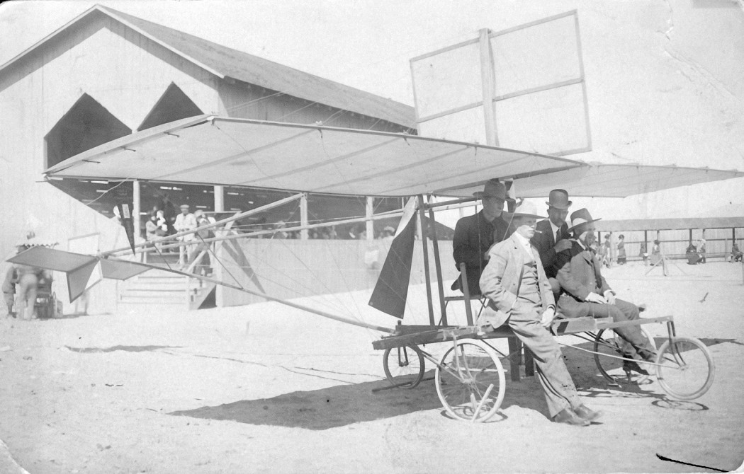 |
| A Pearse monoplane in Douglas AZ. Photo from the Morrow Family website |
Monday
Friday
Air & Space Magazine with Trikes
A great new article in Air & Space magazine about trikes. With 2 videos included it is a great way to promote the sport. Click on the link to read the article. Contributions by Henry Trikelife and Larry Mednick.
Flying an “air trike” is a lot like riding a motorcyle in the air.
Flying an “air trike” is a lot like riding a motorcyle in the air.
The Green River
A recent posting by Jeff's Flight Log of his flight down the Green River. Spectacular scenery and good music accompanies the imagery. About 30 minutes long it is well worth viewing.
Wednesday
Weight Shift Control Light Sport Aircraft in New Mexico
Trike flying in New Mexico. A really nice video of one pilot's view of trike flying in New Mexico. It is good to see more exposure for this unique form of aviation.
Subscribe to:
Posts (Atom)


